- UNESCO
- Free 1st Sunday
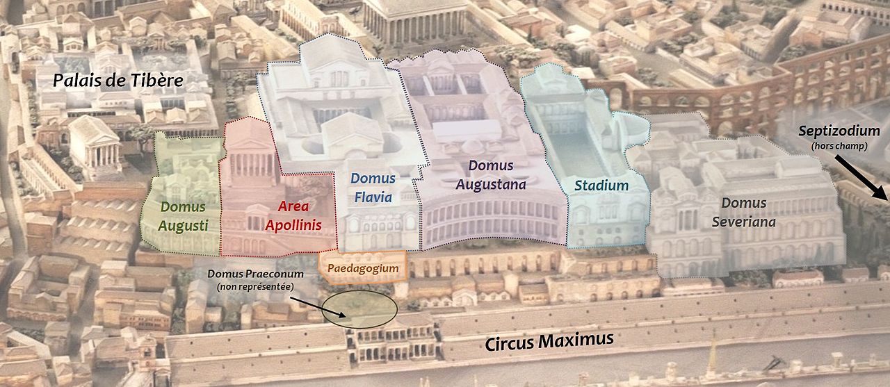
Photo: Cassius Ahenobarbus, CC BY-SA 3.0 · Wikimedia Commons
Archaeological site, 34 BC
Domus aputa
Imperial palace in Rome
- Within the UNESCO World Heritage Site “Historic Centre of Rome, the Properties of the Holy See in that City Enjoying Extraterritorial Rights and San Paolo Fuori le Mura”
At a glance
- Type
- Archaeological site
- Period
- Antiquity, 34 BC
- Coordinates
- 41°53′16″ N, 12°29′12″ E
About
No English description yet
Opening hours and directions are on this page. The full story is on Italian Wikipedia.
Read it in ItalianTimeline
- 34 BCBuilt
Events and people from Wikidata (CC0).
Photos
Getting there
Roma OstienseTrain, nearest
1.7 km as the crow flies
Domus aputa
Aeroporto di Roma-Ciampino13.2 km
Distances are as the crow flies, not walking or driving.
Loading map…
Nearby
See on the mapMore archaeological sites in Lazio
- Free 1st Sunday
- Free 1st Sunday
- UNESCO
Frequently asked questions
Where is Domus aputa?
Domus aputa is in Rome, in the province of Roma (Lazio), Italy. GPS coordinates: 41.88771, 12.48656.
How old is Domus aputa?
Wikidata dates it to 34 BC.
What else is there to see near Domus aputa?
Nearby you’ll find: Domus Augustana (0 m away), Palatine stadium (100 m away), Palatine Hill (100 m away).
Sources and licences
Data. Wikidata (CC0); opening hours and contacts OpenStreetMap (ODbL).
Photos. Wikimedia Commons, author and licence on every image.
Credits for the 8 photos
- Palatin-legende — Cassius Ahenobarbus, CC BY-SA 3.0
- The British Library - Rome - Palazzi del Palatino — The British Library, CC0
- Domus flavia, cortile ottagonale — sebastian_bergmann, CC BY-SA 2.0
- Domus Flavia — Cristiano64, CC BY-SA 3.0
- DomusTiberianafrontenord — Battlelight, Public domain
- Palatino aularegia — Utente:Battlelight, Public domain
- Bust Domitian Musei Capitolini MC1156 — Public domain
- Palatin — Jonas Ulrich, CC BY-SA 3.0
Updated 28 October 2026. All sources and licences