




- UNESCO
- Free 1st Sunday
Photo: Lalupa, Public domain · Wikimedia Commons
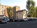
The Aqua Marcia (Italian: Acqua Marcia) is a 91 km (57 mi) long Roman aqueduct, and the longest of eleven aqueducts that supplied the city of Rome. The aqueduct was built between 144–140 BC. The still-functioning Acqua Felice from 1586 runs on long stretches along the route of the Aqua Marcia.
Together with the Aqua Anio Vetus, Aqua Anio Novus and Aqua Claudia, it was an exceptional technical achievement and is regarded as one of the "four great aqueducts of Rome."
Although the source of the aqueduct was further downstream than the Anio Novus, technical progress allowed the later Anio Novus to use more bridges to shorten its path instead of following contour lines as the Marcia does.
It was the first to enter Rome on arches, which were used for the last 11 km (6.8 mi), and which were also used later combined with the Aqua Tepula and Aqua Julia.
At the beginning of the 2nd century BC, the first two aqueducts of Rome (Aqua Appia and Aqua Anio Vetus) had become dilapidated and many illegal diversions decreased the flow so much that in 184 BC the censor Cato the Elder passed laws to remove illegal pipes and supplies to private individuals.
Nevertheless flow rates were still too low to meet growing demand, so the Senate decided to build a new aqueduct, longer and more ambitious than the previous ones, bringing water to the Capitoline Hill, a technical feat for the time due to its height. The praetor Quintus Marcius Rex (an ancestor of Julius Caesar) was entrusted with supervision of the work, for whom it is named and whose judiciary role was extended for the completion of the work. It was largely paid for by spoils from the recent Roman conquests of Corinth in 146 BC and the destruction of Carthage at the end of the Third Punic War, in the same year.
Its extension to the Capitoline Hill caused controversy because traditionalists were concerned about a passage in the Sibylline Books warning against bringing water there and in 140 BC the case was brought before the Senate who rejected it.
It was repaired for the first time in 33 BC by Agrippa then was largely rebuilt by Augustus between 11 and 4 BC following a report of the consuls Quintus Aelius Tubero and Paullus Fabius Maximus. This restoration is commemorated by an inscription placed on the arch spanning the Via Tiburtina, later integrated into the Aurelian Wall. Augustus also augmented the supply by linking it to an additional source, called Augusta after its donor, 800 roman paces—ca. 1,100 m (3,600 ft)—away from the original source.
Much of its supply was eventually siphoned off by private citizens for their own use, making it effectively only a trickle in the city by the time of Nero. The supply was increased again by later emperors. Frontinus measured the flow of the Aqua Marcia at its source around AD 97 as 4690 quinariae, making it the second-greatest source of the city's water. Modern estimates of size of one quinaria vary over a wide range, from 10,000 L (2,600 US gal; 2,200 imp gal) to 76,800 L (20,300 US gal; 16,900 imp gal) of water a day, giving the Aqua Marcia a flow rate of 46,900,000 L (12,400,000 US gal; 10,300,000 imp gal) to 360,192,000 L (95,153,000 US gal; 79,231,000 imp gal) of water a day. …
The ancient source for the aqueduct was near where small lakes were formed by two springs in the Anio valley between the modern towns of Arsoli and Marano Equo. This general locale, in hills to the east of Rome, was also used for other aqueducts including the Anio Vetus, Anio Novus, and Aqua Claudia. The Aqua Marcia was well known for its cold and pure waters and the same source is used today to supply the modern aqueduct.
The route was mainly underground for the first 80 km after which it emerged on large monumental arches to ensure there was a good water head (pressure) for distribution in Rome. The initial stretch of the aqueduct flanked the right bank of the river Anio, crossing it with a bridge just before Vicovaro and joining the route of the Aqua Anio Vetus (at a lower altitude). It continued towards Tivoli and then, bypassing the Tiburtini Mountains and after the current municipality of Gericomio it crossed the Gallicano area and the via Praenestina in Lazio with alternating bridges (of which many are visible) and underground sections. After the Capannelle area it headed directly to Rome and surfaced at the seventh mile of the Via Latina, where there was a limaria pool (settling basin). From here a stretch of about 9 km arches flanked the Via Latina and reached Rome in the locality ad spem veterem, near Porta Maggiore, where other aqueducts met.
From here it followed the future Aurelian Walls until it crossed Via Tiburtina on an arch later transformed into Porta Tiburtina. The route passed the Viminal gate, where Termini Station stands today, and ended near the Collina gate, where the main castellum aquae for distribution stood, near the current Via XX Settembre. The main branch of the subsequent network (which covered 2/3 of the city) reached the Quirinal and then the Capitol, while a secondary branch (rivus Herculaneus), which started from the Tiburtina gate, served the Caelian and the Aventine.
Aqueduct Marcia bridges visible today include: Ponte San Pietro, Ponte Lupo, Ponte Caipoli, Ponte della Bullica, Ponte degli Arci. …
Text from Wikipedia, the free encyclopedia, under CC BY-SA 4.0. Full article: «Aqua Marcia».
Distances are as the crow flies, not walking or driving.


Aqua Marcia is in Ciampino, in the province of Roma (Lazio), Italy. GPS coordinates: 41.84680, 12.56335.
Nearby you’ll find: Anio Novus (200 m away), Aqua Claudia (800 m away), Villa of the Sette Bassi (1.1 km away).
Text. Wikipedia, the free encyclopedia (CC BY-SA 4.0).
Data. Wikidata (CC0); opening hours and contacts OpenStreetMap (ODbL).
Photos. Wikimedia Commons, author and licence on every image.
Updated 28 October 2026. All sources and licences