Saved

Archaeological site, Tivoli (RM)

41°57′00″ N, 12°47′34″ E

No photo on Wikimedia Commons yet

Upload a photo to Commons

Archaeological site

Villa of Brutus

Archaeological remains of a Roman-period platform villa near Tivoli, Italy

Tivoli (RM), Lazio

Directions

At a glance

Coordinates
41°57′00″ N, 12°47′34″ E

Photos

Getting there

TivoliTrain, nearest
1.7 km as the crow flies
Villa of Brutus
Aeroporto di Roma-Ciampino23.6 km

Distances are as the crow flies, not walking or driving.

Loading map…

The town

Things to see in Tivoli54,916 inhabitants, 235 m above sea level. 55 historic places in the town.PhotoRetaggio, CC BY-SA 3.055 places

Do you know this place?

We are missing the opening hours, a description and photos. The data comes from open projects: if you add it there, it appears here at the next update.

More archaeological sites in Lazio

  • UNESCO
  • Free 1st Sunday
Archaeological site, 82 AD

Colosseum

Rome (RM)

Opening hours
  • Free 1st Sunday
Archaeological site, 7th century BC

Ostia

Fiumicino (RM)

Opening hours

See all archaeological sites in Lazio

Frequently asked questions

Where is Villa of Brutus?

Villa of Brutus is in Tivoli, in the province of Roma (Lazio), Italy. GPS coordinates: 41.95000, 12.79274.

What else is there to see near Villa of Brutus?

Nearby you’ll find: Rocca Pia (1.2 km away), Tibur amphitheatre (1.3 km away), Museo didattico del libro antico (1.4 km away).

Sources and licences

Data. Wikidata (CC0); opening hours and contacts OpenStreetMap (ODbL).

Photos. Wikimedia Commons, author and licence on every image.

Credits for the 2 photos
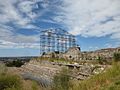
  1. Gezicht op de ruïnes van de villa van Brutus in Tivoli Avanzi della Villa di M. Bruto a Tivoli (titel op object) Malerisch radirte Prospekte aus Italien (serietitel), RP-P-1951-915 — Rijksmuseum, CC0
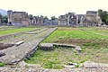
  2. Albert Christoph Dies, Avanzi della Villa di M. Bruto a Tivoli, 1794, NGA 128042 — Albert Christoph Dies, CC0

Updated 28 October 2026. All sources and licences

Spotted a mistake? Fix it on OpenStreetMap