At a glance
- Coordinates
- 41°57′40″ N, 12°47′53″ E
About
No English description yet
Opening hours and directions are on this page. The full story is on Italian Wikipedia.
Read it in ItalianGetting there
Aeroporto di Roma-Ciampino24.7 km
Distances are as the crow flies, not walking or driving.
More archaeological sites in Lazio
Archaeological site, 82 AD Rome (RM)
Opening hours
Archaeological site, 216 AD Rome (RM)
Opening hours
Archaeological site, 7th century BC Fiumicino (RM)
Opening hours
Archaeological site, 100s Rome (RM)
Opening hours
Archaeological site, 80s Rome (RM)
Opening hours
Archaeological site Ciampino (RM)
Opening hours
See all archaeological sites in Lazio
Things to see in Tivoli: 55 historic places
Frequently asked questions
Where is Tibur amphitheatre?
Tibur amphitheatre is in Tivoli, in the province of Roma (Lazio), Italy. GPS coordinates: 41.96100, 12.79800.
What else is there to see near Tibur amphitheatre?
Nearby you’ll find: Rocca Pia (100 m away), Museo didattico del libro antico (200 m away), Villa d'Este (200 m away).
Sources and licences
Data. Wikidata (CC0); opening hours and contacts OpenStreetMap (ODbL).
Photos. Wikimedia Commons, author and licence on every image.
Credits for the 9 photos
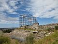
- Anfiteatro di Bleso 2 — Zanner, Public domain
- Anfiteatro di Bleso 1 — Zanner, Public domain
- Anfiteatro di Bleso a Tivoli — Robert Borgia, CC0
- Lavori anfiteatro di Bleso 1983 — Roberto Borgia, CC0
- Rocca Pia e Anfiteatro di Bleso (large) P1030669 — Lalupa, CC BY-SA 4.0
- Rocca Pia e Anfiteatro di Bleso P1030663 — Lalupa, CC BY-SA 4.0
- Rocca Pia et amphithéatre de Bleso — LPLT, CC BY-SA 3.0
- Strada romana nell'anfiteatro di Bleso — Robert Borgia, CC0
- Tivoli - Rocca Pia e Bleso 1030661 — Lalupa, CC BY-SA 3.0
Updated 28 October 2026. All sources and licences
Spotted a mistake? Fix it on OpenStreetMap