

- UNESCO
- Free 1st Sunday
Archaeological site, Riano (RM)
42°00′42″ N, 12°30′01″ E
No photo on Wikimedia Commons yet
Distances are as the crow flies, not walking or driving.
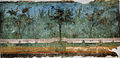
 Things to see in Riano10,322 inhabitants, 125 m above sea level. 8 historic places in the town.PhotoThe original uploader was Carlomorino at Italian Wikipedia., CC BY-SA 3.08 places
We are missing the opening hours, a description and photos. The data comes from open projects: if you add it there, it appears here at the next update.


Villa del Cimitero Flaminio is in Riano, in the province of Roma (Lazio), Italy. GPS coordinates: 42.01156, 12.50019.
Nearby you’ll find: Villa of Livia (1.2 km away), La Celsa (1.8 km away), Casa protostorica di Fidene (3.9 km away).
Data. Wikidata (CC0); opening hours and contacts OpenStreetMap (ODbL).
Updated 28 October 2026. All sources and licences