


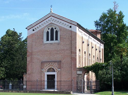
Photo: Syrio, CC BY-SA 4.0 · Wikimedia Commons
Museum, 1936
Military shrine of Asiago
Military shrine in the Italian municipality of Asiago, in the province of Vicenza
At a glance
- Type
- Museum
- Period
- Modern era, 1936
- Materials
- Bronze, brass, marble, building stone
- Coordinates
- 45°52′29″ N, 11°31′13″ E
History and description
The Asiago War Memorial is a World War I memorial located in the town of Asiago in the Province of Vicenza in the Veneto region of northeast Italy. Surrounded by mountains that were the site of several World War I battles, the monument houses the remains of over 50,000 Italian and Austro-Hungarian soldiers and is a popular destination for travelers to the region. In Italian the memorial is called Sacrario Militare di Asiago or Sacrario Militare del Leiten. Leiten is the name of the hill on which the memorial sits.
Background and Construction
Asiago was one of the most symbolic locations of the Great War, having been overrun at the end of May 1916 by the Austro-Hungarian advance. After the war, Asiago was selected to house one of the largest Italian World War I memorials. Venetian architect Orfeo Rossato designed the monument, using one giant block of locally mined white marble of 80 square meters for the base, with the Roman arch added on top. Sculptors Montini and Zanetti also contributed to the work. The memorial was completed in 1938, with an inauguration ceremony held on 17 July. Benito Mussolini presided over the ceremony, and King Victor Emmanuel III was also present. The memorial is on Leiten Hill a few hundred meters from the center of Asiago. Connecting the memorial with the city center is Via degli Eroi (Road of Heroes), which is lined with large cypress trees.
The exterior consists of the square base, on top of which is a terrace with the arch in the middle and an altar located at the center of the arch. The base's sides are each 80 meters long, and two 35-meter staircases lead up to the terrace. The Roman arch is quadrifrons, meaning four-faced with four arches. With its hilltop location and a height of 47 meters, the arch is visible from throughout the Asiago plateau. This arch, along with the memorials of Pasubio, Cimone, and Monte Grappa, has become a symbol of the province of Vicenza. On the parapet of the terrace there are arrows indicating the names of surrounding mountains and important battle sites. Around the entire memorial are original cannons that have been restored. …
Museum
Near the entrance to the crypt is a museum containing many relics gathered from the battlefields of the Asiago plateau, as well as related documents and photographs from the time period of the war. The museum has a plastic model relief map of the Asiago plateau providing a visual depiction of the events that unfolded there. The left side of the museum focuses on the events of the first two years of the war, 1915–1916, and the right side documents the happenings of 1917–1918. The museum also houses a small cinema hall, and video-documentaries may be viewed there upon request.
A noteworthy piece in the museum's collection is a letter from a young soldier on the eve of the Battle of Mount Ortigara, which was discovered in the 1950s. The author, second lieutenant Adolfo Ferrero, fought in the Alpine battle of Val Dora and was a protagonist of the Battle of Mount Ortigara, where he died in combat. This last letter to his family was found in the personal effects of his page, whose mortal remains were exhumed from Mount Ortigara and entombed in the Asiago War Memorial, where Ferrero's remains are also located. Ferrero's family, therefore, never received the letter, but by a strange twist of fate the letter now directly reaches future generations, as part of a monument to never forget the Great War.
Visitor Information
The war memorial and its museum are open to the public every day except on Mondays and the following holidays: New Year's Day, Easter, Easter Monday, May 1, August 15, September 21 (Asiago's patron saint day for St. Matthew), and Christmas. The Winter hours, October 1 to May 15, are 9:00–12:00 and 14:00–17:00. The Summer hours, May 16 to September 30, are 9:00–12:00 and 15:00–18:00.
Text from Wikipedia, the free encyclopedia, under CC BY-SA 4.0. Full article: «Military shrine of Asiago».
Timeline
- 1936Founded
Events and people from Wikidata (CC0).
Photos
Getting there
Carpanè - ValstagnaTrain, nearest
11.0 km as the crow flies
Military shrine of Asiago
Distances are as the crow flies, not walking or driving.
Loading map…
Nearby
See on the mapMore museums in Veneto

- Free 1st Sunday


- Free 1st Sunday

- UNESCO
Frequently asked questions
Where is Military shrine of Asiago?
Military shrine of Asiago is in Asiago, in the province of Vicenza (Veneto), Italy. GPS coordinates: 45.87460, 11.52040.
How old is Military shrine of Asiago?
Wikidata dates it to 1936.
What else is there to see near Military shrine of Asiago?
Nearby you’ll find: Patrizio Rigoni Naturalistic Museum (600 m away), Asiago Astrophysical Observatory (1 km away), Museo della Grande Guerra 15 - 18 (3.4 km away).
Sources and licences
Text. Wikipedia, the free encyclopedia (CC BY-SA 4.0).
Data. Wikidata (CC0); opening hours and contacts OpenStreetMap (ODbL).
Photos. Wikimedia Commons, author and licence on every image.
Credits for the 8 photos
- Sacrario militare di Asiago 02 — Syrio, CC BY-SA 4.0
- Sacrario militare di Asiago - Artiglieria 01 — Syrio, CC BY-SA 4.0
- Sacrario militare di Asiago 01 — Syrio, CC BY-SA 4.0
- Sacrario militare, Asiago — Luukas, Public domain
- Sacrario di Asiago 01 — Superchilum, CC BY-SA 4.0
- Asiago War Memorial 01 — Vajotwo, CC BY-SA 4.0
- Asiago2001 — No machine-readable author provided. Hara1603 assumed (based on copyright claims)., Public domain
- SacrariomilitarediAsiago particolare — aldo battista, CC0
Updated 28 October 2026. All sources and licences