





Photo: Syrio, CC BY-SA 4.0 · Wikimedia Commons
At a glance
- Type
- Fortress / Tower
- Protection
- Italian national heritage
- Coordinates
- 45°53′50″ N, 11°28′51″ E
History and description
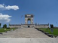
Fort Interrotto, which translates to Interrupted Mountain, is a late 19th century Italian fortification located below the mountain of the same name. Despite being located below the mountain, Interrotto still rises at an altitude of 1392m (4,600ft) and watches over the entire Altopiano dei Sette Comuni (Plateau of 7 Communities). Interrotto was built between 1885 and 1887, and was made out of local stone, significantly weakening it later on. Despite the name, Interrotto was more of a defensible barracks than a fort, and was slightly fortified during World War I. The fort’s armament was 2 12cm guns in casemates.
World War I
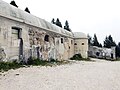
Fort Interrotto was relatively quiet until May 27, 1916, when it was captured by the Austro-Hungarians. The Austro-Hungarians occupied the fort until the end of the war. During the occupation, the Austrians used it as an observation post for the nearby artillery batteries. Interrotto was also connected to Monte Rasta, just below the fort, where an armored observation dome was installed. The Austrians armed Interrotto with light guns during the war. The damage seen today was caused by Italian artillery.
Text from Wikipedia, the free encyclopedia, under CC BY-SA 4.0. Full article: «Caserma Interotto».
Photos
Getting there
Carpanè - ValstagnaTrain, nearest
14.6 km as the crow flies
Caserma Interotto
Distances are as the crow flies, not walking or driving.
Loading map…
Nearby
See on the mapMore fortresses and towers in Veneto


Frequently asked questions
Where is Caserma Interotto?
Caserma Interotto is in Asiago, in the province of Vicenza (Veneto), Italy. GPS coordinates: 45.89733, 11.48080.
What else is there to see near Caserma Interotto?
Nearby you’ll find: Tagliata Val d'Assa (1.2 km away), Museo della Grande Guerra 15 - 18 (3.3 km away), Patrizio Rigoni Naturalistic Museum (3.5 km away).
Sources and licences
Text. Wikipedia, the free encyclopedia (CC BY-SA 4.0).
Data. Wikidata (CC0); opening hours and contacts OpenStreetMap (ODbL).
Photos. Wikimedia Commons, author and licence on every image.
Credits for the 9 photos
- Forte Interrotto by drone 03 — Syrio, CC BY-SA 4.0
- Forte Interrotto - Campane a vento — Syrio, CC BY-SA 4.0
- Forte Interrotto 01 — Syrio, CC BY-SA 4.0
- Forte Interrotto by drone 01 — Syrio, CC BY-SA 4.0
- Forte Ridotto - panoramio — ЭЯMДИИФ БIFFI, CC BY-SA 3.0
- Interno ingresso forte — Antonio Cunico, CC BY-SA 4.0
- Particolare interno forte — Antonio Cunico, CC BY-SA 4.0
- Batteria del Monte Rasta 2023 abc5 — Una tantum, CC BY-SA 4.0
- I 30 45 h luglio — Antonio Cunico, CC BY-SA 4.0
Updated 28 October 2026. All sources and licences