

- UNESCO
- Free 1st Sunday
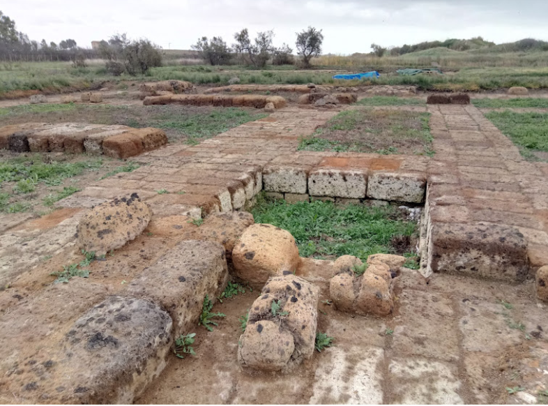
Photo: Rjdeadly, CC BY-SA 4.0 · Wikimedia Commons
Pyrgi (Pyrgus) was originally an ancient Etruscan town and port in Latium, central Italy, to the north-west of Caere. Its location is now occupied by the borough of Santa Severa. It is notable for the discovery here of the gold tablets, an exceptional epigraphic document with rare texts in Phoenician and Etruscan languages, and also the exceptional terracotta pediment statues from the temple.
Excavations by Sapienza University of Rome since 1957 have focussed on the large sacred district, including the Monumental Sanctuary of Uni (Phoenician Astarte) and a Demetriac cult area, the most ancient so far known in Etruria, dedicated to the pair of deities Sur/Suri and Cavatha. In 2009 a block of ceremonial buildings north of Temple A was found.
The foundation of the settlement was ascribed to the Pelasgi and dates from the end of the 7th century BC. The connection between the great Etruscan city of Caere and the coast was ensured by the Caere-Pyrgi road, an impressive work of engineering, 10 m wide and 12 km long, comparable to that between Athens and Piraeus. Caere had three important ports: Punicum (Santa Marinella), Pyrgi and Alsium. Pyrgi's development was closely linked to its favourable position along the Tyrrhenian shipping routes, and it became the main port of Caere and hosted its naval fleet. The abundance of imported objects in the votive deposits highlights the role of Pyrgi as a gateway to the sea under the control of Caere and its openness to international contacts with the frequentation of the area by foreign merchants.
The city was raided by Dionysius in 384 BC who, landing his troops in the night, plundered the temple of Ilithyia from which he is said to have carried off an enormous sum of 1000 talents in gold and silver.
In about 273 Caere was threatened by the Romans with war and to ensure peace it surrendered half its territory. The Romans then established a colonia maritima at Pyrgi around that time against Etruscan pirates and against potential Punic invasion. The colonia was built as a rectangular fort. At the same time the temple buildings were ritually dismantled and worship continued outdoors.
Later the town supplied fish to Rome, and became a favourite summer resort for rich patricians, as did Punicum to the north-west where there are many remains of large ancient villas. Both were stations on the Via Aurelia coast road. In 416 AD its site was occupied only by a large villa.
Pyrgi extended along the shore with two urban districts separated a pebbled road and each facing one of the two ports. The northern district was the arx built on the rocky promontory which was later occupied by the Roman colony. The southern district included buildings and possibly an agora bordered to the south by another wide pebbled road. Nearby, to the south of the town, was the religious sanctuary, one of the most important in Etruria visited by Greeks and Phoenicians.
Remains exist of its Etruscan defensive town walls in polygonal blocks of limestone and sandstone, neatly jointed. They enclosed a rectangular area of some 200 x 220 m. The south-west extremity has been destroyed by the sea.
The 1957 excavations found the remains of a large temple (temple A) with a triple-cella arrangement and with exceptional terracotta statues. The temple was later found to be within the (northern) sanctuary dedicated to Ilithyia and Cavatha (Greek Leucothea) in an area of 6,000 m2 bounded by a side wall and with two monumental temples, the oldest of which is “B”.
Temple B was commissioned around 510 BC by the king of Caere, Thefarie Velianas and consisted of a single cella of Greek inspiration surrounded by columns on all sides. According to the inscriptions of the gold tablets, the temple was dedicated to the Phoenician goddess Astarte (or Uni in Etruscan according to the tablets), warrior goddess and dispenser of love associated with the Greek Ilithyia. Connected with the temple was a wide building with twenty cells where the deitys' priestesses lived. The poet Lucilius referred to them as the "prostitutes of Pyrgi" (scorta Pyrgensia).
On the left of the temple a small precinct "C" with cylindrical altar contained a pit consecrated to the underworld cult of Tinia (the Etruscan version of Jupiter) who is mentioned along with Uni in one of the bronze inscriptions found in the same enclosure together with the gold sheets. …
Text from Wikipedia, the free encyclopedia, under CC BY-SA 4.0. Full article: «Pyrgi».
Distances are as the crow flies, not walking or driving.


Pyrgi is in Santa Marinella, in the province of Roma (Lazio), Italy. GPS coordinates: 42.01523, 11.96341.
Nearby you’ll find: Museum of Santa Severa Castle (500 m away), Santa Severa Castle (500 m away), Museo Civico (600 m away).
Text. Wikipedia, the free encyclopedia (CC BY-SA 4.0).
Data. Wikidata (CC0); opening hours and contacts OpenStreetMap (ODbL).
Photos. Wikimedia Commons, author and licence on every image.
Updated 28 October 2026. All sources and licences