


- UNESCO
- Free 1st Sunday
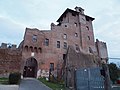
Photo: Ra Boe, CC BY-SA 3.0 · Wikimedia Commons
Portus was a large artificial harbour complex of Ancient Rome located at the mouth of the Tiber on the Tyrrhenian Sea. It was established by Claudius and enlarged by Trajan to supplement the nearby port of Ostia.. At its maximum extent the complex covered an area of about 350 hectares and included many horrea and an imperial palace.
Portus was the main port of ancient Rome for more than 500 years and provided a conduit for everything from glass, ceramics, marble and slaves to wild animals caught in Africa and shipped to Rome for spectacles in the Colosseum.
The archaeological remains of Portus are near the modern-day village of Porto within the comune of Fiumicino, Lazio, just southwest of Rome.
Ancient Rome's original port was Ostia located at the mouth of the Tiber on the Tyrrhenian Sea. The Tiber splits into two streams at its mouth, today roughly 1 mile before reaching the sea due to the constant silting from the mouth of the river, with Ostia situated on the larger southern stream but in Roman times the sea was much nearer to Ostia. Emperor Claudius constructed the first harbour on the Portus site, 4 km (2+1⁄2 mi) north of Ostia, enclosing an area of 250 ha (617 acres). According to Cassius Dio:
Claudius excavated a very considerable tract of land, built retaining walls on every side of the excavation, and then let the sea into it. Secondly, in the sea itself he constructed huge moles on both sides of the entrance and thus enclosed a large body of water, in the midst of which he reared an island and placed on it a tower with a beacon light
The foundation of this lighthouse was provided by filling one of the massive obelisk ships, used to transport an obelisk from Egypt to adorn the spina of the Circus of Caligula. The lighthouse was a famous landmark and probably built in imitation of the Pharos at Alexandria. It was depicted in many ancient sculptures, mosaics, coins etc. and its remains could still be seen in the 15th century.
The harbour opened directly to the sea on the northwest and communicated with the Tiber by a channel on the southeast. The goal was to obtain protection from the prevalent southwest wind, to which the river mouth was exposed. Though Claudius, in the inscription which he erected in 46, stated that he had freed the city of Rome from the danger of inundation, his work was only partially successful: in 62 Tacitus speaks of a number of grain ships sinking within the harbour during a violent storm. Nero gave the harbour the name of "Portus Augusti". A canal, later called the Fossa Traiana (today's Fiumicino canal), was built to connect the Harbour of Claudius with the Tiber, allowing barges to travel up towards Rome with cargo transferred from seafaring cargo ships. …
Many parts of the vast site have been excavated and a large part is open to the public.
Some remains were easily traceable in the 16th century when Pirro Ligorio and Antonio Labacco made plans of the harbour. Considerable excavations were carried out in 1868, but with the idea of recovering works of art and antiquities. The plan and description given by Rodolfo Lanciani (Annali del institute, 1868, 144 sqq.) were made under unfavourable circumstances.
Excavations in 2007-2012 through the Portus Project focussed on the area between the hexagonal harbour and the Claudian basin, and particularly on and around the so-called Imperial Palace. Excavation is continuing especially in the Great Horrea of Septimius Severus.
A large part of the northern mole of the Claudian harbour has been excavated and is visible near the airport and the Ship Museum.
Just across the canal from the entrance to Portus, excavations in 1975-77 brought to light baths from the late 2nd century AD, together with a sanctuary of the Egyptian deity Isis Pharia, protector of sailors. The sanctuary is known from inscriptions relating to the last restorations in 375-378, a few years before the suppression of pagan cults by Theodosius in 380. The temple was identified due to the discovery of a large statue now in the Ostiense Museum of a draped female figure with the serpent Agathodaimon ("benevolent genius").
To the west of the harbour is the 10th century cathedral of Saint Rufina, modernized except for the campanile, and the episcopal palace, fortified in the Middle Ages, and containing a number of ancient inscriptions from the site. On the ancient island of Isola Sacra nearby is the church of S. Ippolito built on the site of a Roman building, with a picturesque medieval campanile (13th century?), as well as the Isola Sacra Necropolis.
Text from Wikipedia, the free encyclopedia, under CC BY-SA 4.0. Full article: «Portus».
Events and people from Wikidata (CC0).
Distances are as the crow flies, not walking or driving.


Portus is in Rome, in the province of Roma (Lazio), Italy. GPS coordinates: 41.77917, 12.26667.
Wikidata dates it to 46.
Nearby you’ll find: Episcopio di Porto (500 m away), Isola Sacra Necropolis (1.1 km away), Museo delle navi romane (1.3 km away).
Text. Wikipedia, the free encyclopedia (CC BY-SA 4.0).
Data. Wikidata (CC0); opening hours and contacts OpenStreetMap (ODbL).
Photos. Wikimedia Commons, author and licence on every image.
Updated 28 October 2026. All sources and licences