



- Most beautiful villages
Photo: Hagai Agmon-Snir حچاي اچمون-سنير חגי אגמון-שניר, CC BY-SA 4.0 · Wikimedia Commons
Monteleone di Spoleto is a town and comune in the province of Perugia, in southeastern Umbria. It stands at 978 meters (3,209 ft) above sea level, overlooking the upper valley of the Corno River. It is included among I Borghi più belli d'Italia ("The Most Beautiful Villages of Italy").
In 2021 the municipality had a population of 539 inhabitants.
Monteleone was said to have been founded around the year 250 by a Tiberto degli Arroni. The settlement was later fortified by the Spoletans, who surrounded it with walls and restored its fortress.
Little remains of the Roman settlement. The town was destroyed and rebuilt by the Spoletans in the 12th century and today retains a predominantly medieval character.
In 1326 the community was erected as a free comune and, by decree of the Holy See, removed from the jurisdiction of Spoleto. During the 14th century its territory was organized into three terzieri, named San Nicola, Santa Maria and San Giacomo.
In 1527 the town was directly occupied by Spoleto, and a military garrison was installed. In the early 1540s it was incorporated into the Governorate of Norcia, Cascia, Cerreto and Monteleone, and a podestà-commissario was appointed. Between the 1540s and 1560 a succession of podestà, commissari and luogotenenti governed the community, appointed either by the pope or by the papal legate of Perugia.
Between 1560 and 1565 new municipal statutes were compiled. In 1569, under Pope Pius V, the Prefettura della Montagna was established.
During the Roman Republic of 1798 the town was assigned to the Canton of Cascia in the Department of Clitunno. After the fall of the Republic, the traditional magistracy of priori was reinstated and a vice governor appointed. In 1802 the town was reintegrated into the Prefettura della Montagna.
From 1809 to 1814, under French rule, a maire was introduced. The town was assigned to the Canton of Cascia, within the Circondario of Spoleto in the Department of Trasimeno. Following the collapse of Napoleonic authority in 1814, a provisional regency was established, and in 1815 the offices of luogotenente and priori were restored.
On 6 July 1816 the town was included in the Delegation of Spoleto. In 1833 the town became dependent on the Governor of Cascia, and the office of podestà ceased to be present locally.
In 1859 the municipality had a total population of 1,662 inhabitants. Of these, 270 people lived in the countryside, while the main settlement of Monte Leone contained 915 inhabitants. The remainder lived in three hamlets, which also served as parishes: Buttine (183 inhabitants), Ruscio (348 inhabitants), and Trivio (216 inhabitants).
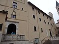
The church of San Francesco was built in the 14th century over a 12th-century Benedictine oratory. Although titled to the Madonna dell'Assunta, it has been known as San Francesco since Franciscans settled there around 1280.
The complex was restored in the 15th century and then extensively altered after the January 1703 earthquake; between 1395 and 1398 the floor was raised, creating a lower worship space and reducing the original interior height by about one third, a change still visible where the floorline cuts across a Crucifixion fresco on the left wall. The north-facing façade retains a Romano-Gothic pointed portal with twisted columns and reliefs attributed to Lombard craftsmen, and a lunette fresco of Mary between Saint Francis of Assisi and Saint Nicholas.
Inside, two naves are divided by stone pillars; the main nave has a painted wooden ceiling by Giuseppe Frigerio da Norcia dated 1760, and surviving fresco cycles date from the 14th to the 16th centuries. The upper cloister preserves nine 18th-century tempera lunettes (first half of the 18th century) on the life of Saint Francis, and an antiquarium-like display with Roman, medieval, and modern fragments, including the Roman funerary inscription of Sextus Vettulenus found at Forca di Usigni (municipality of Poggiodomo).
The former lower church later served as a burial place and retains repainted Franciscan frescoes dated to the early 15th century; arcosolia have been brought to light on the right wall. The sacristy holds a 13th-century wooden Madonna and Child from Castevecchio.
The former convent and church of Santa Caterina is documented from 1310, when ten Augustinian nuns were granted a site near the castle walls, next to the chapel of Sant'Agnese outside the walls belonging to the parish church of San Nicola. After five years they moved to a new monastery built near San Giovanni al Borgo, later returning to the original site at an unknown date.
The church, now in ruins, was damaged in the 1703 earthquake but repaired and back in use by 1715. Its plan is described as an ovoid generated by four intersecting equilateral triangles. With the laws of 1866 the convent was suppressed, its property confiscated by the state, and the nuns moved to Cascia. …
Text from Wikipedia, the free encyclopedia, under CC BY-SA 4.0. Full article: «Monteleone di Spoleto».
Our data shows no stations, stops or car parks nearby. Check how to get there before you set out.


Monteleone di Spoleto is in Monteleone di Spoleto, in the province of Perugia (Umbria), Italy. GPS coordinates: 42.65159, 12.95184.
Nearby you’ll find: Monastero di S. Rita (Cascia, Italy) (8.8 km away), Museo civico di Palazzo Santi (8.9 km away), Palazzo Frenfanelli (9 km away).
Text. Wikipedia, the free encyclopedia (CC BY-SA 4.0).
Data. Wikidata (CC0); opening hours and contacts OpenStreetMap (ODbL).
Photos. Wikimedia Commons, author and licence on every image.
Updated 28 October 2026. All sources and licences