





- Most beautiful villages
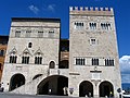
Photo: Hagai Agmon-Snir حچاي اچمون-سنير חגי אגמון-שניר, CC BY-SA 4.0 · Wikimedia Commons
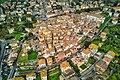
Massa Martana is a comune (municipality) in the Province of Perugia in the Italian region Umbria, located about 60 kilometres (37 mi) south of Perugia and about 25 kilometres (16 mi) north of Terni.
It is one of the classic walled towns of central Italy. The modern town has spread northwards along the road. It is one of I Borghi più belli d'Italia ("The most beautiful villages of Italy").
About 1.5 miles (2.4 km) away, settlements had existed since the time of Augustus along the Via Flaminia. These developed into a center known as Vicus Martis, after a temple to Mars erected by Vespasian, and later took the name Civitas Martana.
The ancient settlement was partially destroyed by an earthquake in 306, and its ruin was completed by the Goths in 546, the Lombards in 590, and finally by the Saracens around 830. From its remains arose several nearby castles, including Colpetrazzo, Montemartano, San Felice di Giano, and Santa Maria in Pantano. The latter site lay in a large plain marked by water channels, believed to be the remains of aqueducts from the ancient city.
The origins of Massa Martana itself date to the Lombard period in the 7th–8th century, when a castle was founded. In the 10th century it was held by the Arnolfi family as part of the Terre Arnolfe, during which time its fortifications were strengthened.
The Bentivenga family were the feudal lords of Massa and enclosed the settlement with walls, which still survive.
In 1305 the settlement was besieged by the Ghibellines of Todi, an event that prompted the intervention of Perugia and Pope Benedict XI. In 1397 Pope Boniface IX removed its control from Todi and placed it under direct papal protection, though in 1403 the same pope restored it to Todi.
During the 15th century the inhabitants revolted against Todi on several occasions, notably in 1432, 1469, and 1473.
In 1565 the Apostolic Camera sold the town to Todi for 23,000 gold scudi; the inhabitants subsequently repurchased it for 11,000. In 1571 it was placed under the protection of the College of Cardinals, and its statutes were reformed.
During the Napoleonic period it was reorganized as a mairie with expanded jurisdiction.
In 1860 Massa Martana was annexed to the Kingdom of Italy, and in 1863 it assumed its current name. In the 19th century Massa had a population of 2,629 inhabitants, of whom 517 lived in the town and 2,112 in the countryside.
The buildings of the walled town suffered major damage in an earthquake on May 12, 1997, a precursor of the 1997 earthquake which damaged much of Umbria, including the Basilica and city of Assisi. The Commune celebrated the completion of restoration works and the reopening of the old town in August 2006, ten years after the earthquake.
Text from Wikipedia, the free encyclopedia, under CC BY-SA 4.0. Full article: «Massa Martana».
Distances are as the crow flies, not walking or driving.


Massa Martana is in Massa Martana, in the province of Perugia (Umbria), Italy. Address: Comune di Massa Martana,Via Giuseppe Mazzini, 3. GPS coordinates: 42.77559, 12.52325.
Nearby you’ll find: Via Flaminia (7.2 km away), Abbey of San Felice (8.4 km away), Palazzo del Popolo (9.5 km away).
Text. Wikipedia, the free encyclopedia (CC BY-SA 4.0).
Data. Wikidata (CC0); opening hours and contacts OpenStreetMap (ODbL).
Photos. Wikimedia Commons, author and licence on every image.
Updated 28 October 2026. All sources and licences