


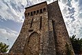

- Most beautiful villages
Photo: Hagai Agmon-Snir حچاي اچمون-سنير חגי אגמון-שניר, CC BY-SA 4.0 · Wikimedia Commons
Acquasparta is a town and comune in the province of Terni (Umbria, central Italy). It is located on a hill above the Naia Valley and the river of the same name, facing the Monti Martani mountain range.
Acquasparta is one of I Borghi più belli d'Italia ("The most beautiful villages of Italy"). It also sits between two hot springs, the Amerino and the Furapane.
During the ancient Roman domination the area was a retreat – a spa whose mineralized hot water baths were easily accessible from Rome along the west branch of the via Flaminia. Thermal baths remain open to the public today.
The first reliable evidence for the existence of a settled nucleus at Acquasparta dates to the end of the 10th century. At the time, the territory of Acquasparta formed part of the Terre Arnolfe, lands between Spoleto, Todi and Terni granted by Otto I to Count Arnolf. At an unspecified date it was then subject to the Abbey of Farfa.
By the end of the 12th century the area was ruled by the descendants of Arnolf, known as the Bentivenga family, also referred to as the nobles of Acquasparta. In 1233 the settlement was subjugated by Todi, under whose jurisdiction it remained from the 13th to the 15th century.
On 8 August 1489 it was granted the status of terra franca (free land) by Pope Innocent VIII, implying a degree of local autonomy.
Around 1500, during factional conflicts within Todi, Acquasparta was occupied by one faction and attacked by Altobello da Chiaravalle. The intervention of Pope Alexander VI, supported by leading mercenary captains, led to the destruction of the castle, the capture of Altobello, and the reintegration of the territory into the former Terre Arnolfe. On 10 March 1507 Pope Julius II visited the town, which was still experiencing shortages of food and basic goods as a consequence of those events.
In 1538 Pope Paul III sold Acquasparta to Pier Luigi Farnese. In 1540 it was transferred to Isabella Liviani, wife of Gian Giacomo Cesi, marking the beginning of Cesi family rule over Acquasparta and Portaria. In 1588 Pope Sixtus V elevated the territory to a duchy, with Federico Cesi as its first duke. The duchy reached its peak in the late 16th century under Federico II Cesi.
After the death of Federico II Cesi succession passed to Giovanni Federico Cesi, who resided in Rome and governed through an appointed representative. The plague of 1630 affected the town, and the 1703 Apennine earthquakes caused damage in the area. …
Located outside the town walls, the Church of San Francesco was built in 1294 by Cardinal Matteo Bentivenga d'Acquasparta. It represents a typical example of early Franciscan architecture, marking a transition from Romanesque forms.
Inside the church is an icon of the Virgin and Child dating to the first half of the 14th century, traditionally venerated under the title of Madonna della Stella and associated with episodes such as plagues, earthquakes, and wars. Also preserved is a Franciscan painting copied from a work by Margaritone d'Arezzo, depicting Saint Francis and episodes from his life, as well as an ancient 14th-century wooden crucifix brought to the church from San Giovanni di Butris.
In the sacristy is an octagonal ciborium decorated with oil paintings attributed to Rinaldo di Calvi, depicting figures including Saint Francis, Saint Clare, Saint Louis, and Saint Bernardino of Siena. The cloister preserves elements of the original construction, including columns and a well.
Inside is a votive fresco dated 1430 depicting the Virgin enthroned with saints. The high altar features a mensa supported by twelve small columns in Gothic style.
The church of Santa Cecilia, dedicated to the patron saint of the town, dates to the 12th century, as evidenced by its apse. Of particular interest is the Cesi Chapel, built in 1581 by Isabella Liviani Cesi, great-grandmother of Federico Cesi.
Within the collegiate church are seven canvases placed in the chapels, executed by various painters from the late 16th century to the second half of the 18th century.
The Church of the Madonna del Giglio, located opposite the Porta Vecchia which formerly served as the entrance to the town, dates to the 17th century. Inside are numerous frescoes, some of which remain well preserved.
The Church of the Sacrament was built in 1684 by the Confraternity of the Most Holy Sacrament. The building has a square plan and originally had a wooden trussed roof until the mid-19th century. Inside is a fragment of a Roman mosaic originating from the ancient city of Carsulae.
Other churches include:
Madonna of the Cross: church completed in 1606
Santissimo Sacramento: church incorporating a Roman Mosaic in its floor, is a very good example of 17th-century architecture
San Giovanni de Butris: church a short way from Acquasparta, built on the remains of a Roman bridge, and incorporates very large Roman stone blocks.
Text from Wikipedia, the free encyclopedia, under CC BY-SA 4.0. Full article: «Acquasparta».
Distances are as the crow flies, not walking or driving.


Acquasparta is in Acquasparta, in the province of Terni (Umbria), Italy. Address: Comune di Acquasparta, Corso Umberto I, 1. GPS coordinates: 42.69039, 12.54622.
Nearby you’ll find: Palazzo Cesi (100 m away), Via Flaminia (5.5 km away), Area archeologica di Carsulae (5.6 km away).
Text. Wikipedia, the free encyclopedia (CC BY-SA 4.0).
Data. Wikidata (CC0); opening hours and contacts OpenStreetMap (ODbL).
Photos. Wikimedia Commons, author and licence on every image.
Updated 28 October 2026. All sources and licences