

- UNESCO
Photo: Luca Giarelli, CC BY-SA 3.0 · Wikimedia Commons
Abbey / Monastery, 11th century
Monastery of San Salvatore
Capo di Ponte (BS), Lombardy
Monastero di San Salvatore (Monastery of San Salvatore) is located on the left bank of the Oglio river, in the municipality of Capo di Ponte in Val Camonica, Italy. Established at the end of the 11th century, it was the first and only Cluniac priory in Val Camonica. The monastery is an important example of early medieval Romanesque architecture.
Text from Wikipedia, the free encyclopedia, under CC BY-SA 4.0. Full article: «Monastero di San Salvatore».
Events and people from Wikidata (CC0).
Distances are as the crow flies, not walking or driving.
 Rock art Natural reserve of Ceto, Cimbergo and Paspardo1.1 km
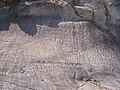 The National Park of Rock Engravings in Capo di Ponte1.1 km
 Museo didattico di arte e vita preistorica della Val Camonica1.4 km
 National Park of Rock Engravings of Naquane1.4 km
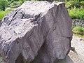 Val Camonica - Arte Rupestre - Parco Archeologico Nazionale dei Massi di Cemmo1.4 km
 Castello di Cimbergo1.7 km
 Museo dell'energia idroelettrica di Valcamonica4.0 km


Monastero di San Salvatore is in Capo di Ponte, in the province of Brescia (Lombardy), Italy. GPS coordinates: 46.03944, 10.35333.
Wikidata dates it to the 11th century.
Nearby you’ll find: Rock art Natural reserve of Ceto, Cimbergo and Paspardo (1.1 km away), The National Park of Rock Engravings in Capo di Ponte (1.1 km away), National Museum of Prehistory of Valle Camonica (1.2 km away).
Text. Wikipedia, the free encyclopedia (CC BY-SA 4.0).
Data. Wikidata (CC0); opening hours and contacts OpenStreetMap (ODbL).
Photos. Wikimedia Commons, author and licence on every image.
Updated 28 October 2026. All sources and licences