


- UNESCO
- Free 1st Sunday
Photo: Rossignol Benoît, CC BY-SA 4.0 · Wikimedia Commons
Archaeological site
Archaeological site in Capena, Italy
Lucus Feroniae was an ancient sanctuary or, literally sacred grove ("lucus"), dedicated to the Sabine goddess Feronia, protector of freedmen, ex-slaves. It was located near to the ancient town of Feronia in Etruria on the ancient Via Tiberina, in what is now the territory of the modern commune of Capena, Lazio.
It was partially excavated when the A1 Rome-Milan motorway which crosses it was built, and the archaeological site is adjacent to that of the ancient Roman Villa dei Volusii.
The sanctuary was located near the later port on the Tiber, facing the Sabine settlement of Cures nearby. Later the forum was built on its south side.
According to the 1st-century BCE Greek historian Dionysius of Halicarnassus, there was a sanctuary dedicated to Feronia that was honored by both the Sabines and the Latins. Dionysius records that there was a festival at this temple, during the days of which many would travel there from surrounding cities with either the religious goal of offering sacrifices or performing vows, or for the commercial goal of selling their goods as merchants, artisans, or farmers. Archaeological excavation at the site has confirmed the presence of rings, seals, numerous coins—many of which originate from Campania—and also pottery, sometimes brought from elsewhere, but also sometimes produced locally either for dedications or trade.
This festival of Feronia is perhaps the very same as the annual ceremony at Soracte honoring the goddess described by the 1st-century BCE geographer Strabo, who claims that the ceremony was attended by a great multitude of people. According to Strabo, individuals possessed by Feronia could perform acts of firewalking, and this feat was supposedly performed at the festival, thus attracting many visitors who wished to view the stunt. It is, however, possible that Strabo merely confused the festival of Feronia with the nearby festival of Apollo Soranus, which was also situated on Mount Soracte, and—according to Pliny the Elder—also the location of a firewalking ritual. There is no inscriptional evidence attesting to worship of Feronia at Soracte, save for possibly one text now stored at Nepi that was—according to the Italian archaeologist Fulvio Orsini—found at this mountain. However, earlier accounts of this same text provide no indication that the artifact was not discovered at Nepi, allowing for the possibility that Orsini simply assumed that the text derives from Soracte on the basis of the connection between the mountain and Feronia in Roman literary sources. …
The site was first discovered in 1953 and explored by the Soprintendenza Archeologia, Belle Arti e Paesaggio per l’area metropolitana di Roma, la Provincia di Viterbo e l’Etruria Meridionale.
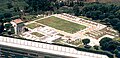
Archaeological excavations at the site unearthed, besides a sanctuary, a small town containing a forum. The forum was unpaved and built on a north-south axis, to the west of which lay a colonnade consisting of Tuscan columns, itself in front of a set of tabernae. East of the forum, there was a reticulate wall supporting a part of the Aqua Augusta. Various sacred buildings were situated to the north of the forum, such as the altar of Feronia, a small Classical temple, an aerarium, a travertine podium connected to a basilica, and an Augusteum. Moreover, in 1961, researchers unearthed evidence of a Republican-period temple to the east of the forum. The town lies at the intersection of two roads, known respectively as the Via Capenate and the Via Tiberina. The Via Tiberina extends westward from the forum, eventually joining with the Via Capenate. In the space between these two roads, west of the forum, there lies an amphitheater dated, on account of its building materials—particularly the usage of opus reticulatum with tufa quoins—to the early 1st-century CE. The amphitheater underwent later repairs during the early 2nd-century CE, as indicated by the presence of brick stamps. …
Text from Wikipedia, the free encyclopedia, under CC BY-SA 4.0. Full article: «Lucus Feroniae».
Distances are as the crow flies, not walking or driving.


Lucus Feroniae is in Capena, in the province of Roma (Lazio), Italy. Address: via Tiberina, Km. 18.500 - Capena. GPS coordinates: 42.13000, 12.59667.
Yes: entry is free on the first Sunday of every month, under the Italian “Domenica al museo” scheme.
Nearby you’ll find: Villa of the Volusii Saturnini (500 m away), Museo della strumentazione e informazione cristallografica (4.4 km away), Ducal Castle Orsini (4.6 km away).
Text. Wikipedia, the free encyclopedia (CC BY-SA 4.0).
Data. Wikidata (CC0); opening hours and contacts OpenStreetMap (ODbL).
Photos. Wikimedia Commons, author and licence on every image.
Updated 28 October 2026. All sources and licences