



- UNESCO
- Free 1st Sunday
Photo: Lalupa, CC BY-SA 3.0 · Wikimedia Commons
Archaeological site
Archaeological site in Rome, Italy
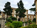
The Horti Spei Veteris, later called Horti Variani, was a luxurious and important palace-estate, eventually the residence of Emperors, on the Esquiline Hill at the south eastern corner of ancient Rome and covering an area of 12,000 m2.
Remains are still visible today near the Porta Maggiore and the church of Santa Croce in Gerusalemme.
The area near the Porta Prenestina (now Porta Maggiore) where the Via Labicana and the Via Prenestina branched off was called ad spem veterem. The name derives from a republican temple to the goddess Spes (Hope) built in 477 BC after the victory over Veii at the Battle of the Cremera. The "veterem" qualification was used to distinguish this temple from the one built in the 3rd century BC in the Forum Holitorium, at the time of the first Punic Wars.
The area was suburban but close to the Forum and well supplied with water by virtue of the fact that, by the middle of the 1st century BC, eight of Rome's eleven aqueducts converged there. At the same time, it became a prestigious residential area, accentuated as the city became more crowded and noisy.
The Horti Spei Veteris were included in the imperial properties by Emperor Septimius Severus (r. 193–211), who built the first imperial residence in the area. Emperor Caracalla (r. 198–217) built the Circus Varianus there, and later emperor Elagabalus (r. 218–222) raced chariots under the family name of Varius. The subsequent name of Horti Variani is due to the inclusion of the nearby land belonging to Sextus Varius Marcellus, father of emperor Elagabalus, into imperial state property. Elagabalus made it his favourite retreat and designed it (as for Nero's Domus Aurea project) as a vast suburban villa divided into various building and landscape nuclei, modifying the circus (later replicated by Maxentius in his villa on the Appian Way) and building the Amphitheatrum Castrense. He also built the great atrium (later to become S. Croce) and a triumphal arch. The "public" part was already called the Sessorium in his time, as the sessions of the Council of State were held there.
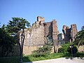
Between 271 and 275, construction of the Aurelian Walls interrupted the Horti's vast continuity, cutting the Circus Varianus in two and incorporating the Amphitheatrum Castrense into the walls as a bastion. …
The complex of the Horti Spei Veteris was developed under Elegabalus from a circus-palace association model for imperial and other luxurious palaces, completely integrated with the other buildings. This model was first created in the Horti Pompeiani and continued with the Domus Augustana linked to the Circus Maximus, used as a sumptuous scenic backdrop. The model was also used in other imperial palaces such as Hadrian's Villa, the villas of Domitian at Albano and Terracina, and the Villa of Maxentius.
A large circular building in opus testaceum came to light between 1995 and 1999, next to the Castrense Amphitheatre, connecting the rear part of the villa Sessorium with the Circus Varianus as part of a structure with a long covered driveway which flanked the large atrium. The building had monumental dimensions: the 1.8 m thick perimeter wall delimited a room with an external diameter of about 30 m and at least 16 m high, i.e., as high as the large driveway portico of which it constituted the western end. The fabric of the curtain walls of the circular building, the amphitheatre, and the atrium shows that they were conceived and built almost simultaneously, as part of a grandiose unitary project carried out by Elagabalus on the western elevation of the residence.
The large circular room represents the end of a porticus triumphi building, a very particular type of public building of late Republican origin converted here for private use. This type of building, of monumental dimensions, consists of a long portico divided in half by a central spine or colonnade into parallel passages and ending with two circular rooms. The sections found show a building about 14 m wide and 16 high, probably covered with a roof, in whose walls were doors and windows at irregular intervals, determined by the disposition of the adjacent buildings and the paths that led to it; at some points, the external elevation was enlivened by niches. The building is very similar, though longer at 369 m, to the Pecile of Hadrian's Villa and similar to that of the villa of Domitian at Terracina. …
Text from Wikipedia, the free encyclopedia, under CC BY-SA 4.0. Full article: «Horti Spei Veteris».
Distances are as the crow flies, not walking or driving.


Horti Spei Veteris is in Rome, in the province of Roma (Lazio), Italy. GPS coordinates: 41.88847, 12.51528.
Nearby you’ll find: Museo storico dei Granatieri di Sardegna (100 m away), Historical museum of infantry (100 m away), Sessorium (100 m away).
Text. Wikipedia, the free encyclopedia (CC BY-SA 4.0).
Data. Wikidata (CC0); opening hours and contacts OpenStreetMap (ODbL).
Photos. Wikimedia Commons, author and licence on every image.
Updated 28 October 2026. All sources and licences