
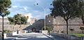


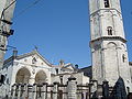
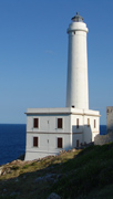
Photo: trolvag, CC BY-SA 3.0 · Wikimedia Commons
At a glance
- Type
- Lighthouse
- Period
- Modern era, 1868
- Coordinates
- 41°37′44″ N, 15°55′24″ E
History and description
Manfredonia Lighthouse (Italian: Faro di Manfredonia) is an active lighthouse located at the debut of the east pier of the harbour of Manfredonia, in Apulia on the Adriatic Sea.
Description
The lighthouse was built in 1868 and consists of a white octagonal prism tower, 18 metres (59 ft) high, with balcony and lantern, rising from a 2-storey white keeper's house. The lantern, painted in grey metallic, is positioned at 20 metres (66 ft) above sea level and emits one white flash in a 5 seconds period, visible up to a distance of 23 nautical miles (43 km; 26 mi). The lighthouse is completely automated and is managed by the Marina Militare with the identification code number 3796 E.F.
Text from Wikipedia, the free encyclopedia, under CC BY-SA 4.0. Full article: «Manfredonia Lighthouse».
Timeline
- 1868Built
Events and people from Wikidata (CC0).
Photos
Getting there
ManfredoniaTrain, nearest
1.4 km as the crow flies
Manfredonia Lighthouse
Aeroporto di Foggia "Gino Lisa"39.0 km
Distances are as the crow flies, not walking or driving.
Loading map…
Nearby
See on the mapDo you know this place?
We are missing the opening hours. The data comes from open projects: if you add it there, it appears here at the next update.
More lighthouses in Puglia (Apulia)


Frequently asked questions
Where is Manfredonia Lighthouse?
Manfredonia Lighthouse is in Manfredonia, in the province of Foggia (Puglia (Apulia)), Italy. GPS coordinates: 41.62889, 15.92333.
How old is Manfredonia Lighthouse?
Wikidata dates it to 1868.
What else is there to see near Manfredonia Lighthouse?
Nearby you’ll find: Museo archeologico nazionale di Manfredonia (200 m away), Castello svevo angioino (200 m away), Siponto (3.3 km away).
Sources and licences
Text. Wikipedia, the free encyclopedia (CC BY-SA 4.0).
Data. Wikidata (CC0); opening hours and contacts OpenStreetMap (ODbL).
Photos. Wikimedia Commons, author and licence on every image.
Credits for the 9 photos
- Manfredonia, Province of Foggia, Italy - panoramio - trolvag (1) — trolvag, CC BY-SA 3.0
- Manfredonia - Faro di Manfredonia - 2025-09-29 16-00-00 001 — VincenzoCitoli, CC BY-SA 4.0
- Manfredonia - Faro di Manfredonia - 2025-09-29 16-01-30 001 — VincenzoCitoli, CC BY-SA 4.0
- Manfredonia - Faro di Manfredonia - 2025-09-29 18-01-47 001 — Matteo_Nuzziello, CC BY-SA 4.0
- Manfredonia - faro di Manfredonia - 2026-09-15 13-02-44 001 — TeKappa, CC BY-SA 4.0
- Manfredonia - Manfredonia Lighthouse - 2024-09-20 22-49-32 001 — Matteo Nuzziello, CC BY-SA 4.0
- Manfredonia - Manfredonia Lighthouse - 2024-09-20 22-50-56 001 — Matteo Nuzziello, CC BY-SA 4.0
- Manfredonia - Manfredonia Lighthouse - 2024-09-20 22-51-42 001 — Matteo Nuzziello, CC BY-SA 4.0
- Manfredonia faro porto molo levante — Marco La Torre, CC BY-SA 4.0
Updated 28 October 2026. All sources and licences