


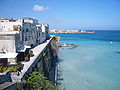

Photo: Original uploader was user:Dinobortone at it.wikipedia, CC BY-SA 3.0 · Wikimedia Commons
At a glance
- Type
- Lighthouse
- Period
- Modern era, 1867
- Coordinates
- 40°06′27″ N, 18°31′12″ E
History and description
Punta Palascia Lighthouse (Italian: Faro di Punta Palascia) is an active lighthouse located in Capo d'Otranto, which is the easternmost point in Italy and the narrowest point of Strait of Otranto at the mouth of Adriatic Sea.
Description
The lighthouse was built in 1867 and abandoned in the 1970s, however, was reopened in 2008 and currently hosts the Centre on Environment and Health of the Mediterranean Ecosystems and a multimedia Museum of the Sea. The lighthouse consists of a white stone cylindrical tower, 32 metres (105 ft) high, with balcony and lantern rising from a two-storey white building. The lantern is positioned at 60 metres (200 ft) above sea level and emits one white flash in a five-second period visible at distances up to 18 nautical miles (33 kilometres). The lighthouse is fully automated and is managed by the Marina Militare and is identified by the code number 1983 E.F.
The lighthouse is one of five Mediterranean lighthouses protected by the European Commission. It is open to guided tours for visitors, particularly at New Year, since it stands at the eastern point of Italy where the dawn of the New Year can be seen before the rest of the country.
Text from Wikipedia, the free encyclopedia, under CC BY-SA 4.0. Full article: «Punta Palascia Lighthouse».
Timeline
- 1867Built
Events and people from Wikidata (CC0).
Photos
Getting there
OtrantoTrain, nearest
5.7 km as the crow flies
Punta Palascia Lighthouse
Port5.2 km
Aeroporto "Fortunato Cesari"35.9 km
Distances are as the crow flies, not walking or driving.
Loading map…
Nearby
See on the mapMore lighthouses in Puglia (Apulia)


Frequently asked questions
Where is Punta Palascia Lighthouse?
Punta Palascia Lighthouse is in Otranto, in the province of Lecce (Puglia (Apulia)), Italy. GPS coordinates: 40.10742, 18.51988.
How old is Punta Palascia Lighthouse?
Wikidata dates it to 1867.
What else is there to see near Punta Palascia Lighthouse?
Nearby you’ll find: Torre Palascia (0 m away), Monastero di S. Nicola di Casole (2.5 km away), Torre Sant'Emiliano (2.7 km away).
Sources and licences
Text. Wikipedia, the free encyclopedia (CC BY-SA 4.0).
Data. Wikidata (CC0); opening hours and contacts OpenStreetMap (ODbL).
Photos. Wikimedia Commons, author and licence on every image.
Credits for the 9 photos
- Faro-palascia — Original uploader was user:Dinobortone at it.wikipedia, CC BY-SA 3.0
- FARO DI PUNTA PALASCIA — Floliva, CC BY-SA 4.0
- Faro di Punta Palascia al tramonto — Abbrey82, CC BY-SA 4.0
- Otranto faro Punta Palascia — Esposito Luciano - original uploader was Gabbiano64 at it.wikipedia, Public domain
- Capo-dotranto---punta-palascia 9029358357 o 02 — Daniel Ventura, CC BY-SA 4.0
- Punta Palascia — Pepemanuele, CC BY-SA 4.0
- Palascialba — Linosalento, CC BY-SA 3.0
- Dal Salento all'Albania — Abbrey82, CC BY-SA 4.0
- L’Infinito — The vince f, CC BY-SA 4.0
Updated 28 October 2026. All sources and licences