


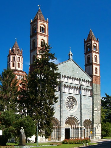
Photo: Stefano massobrio, CC BY-SA 4.0 · Wikimedia Commons
Abbey / Monastery
Convent Complex of Saint Francis
Former franciscan convent, former army hospital
Alessandria (AL), Piedmont
At a glance
- Type
- Abbey / Monastery
- Style
- Italian Gothic architecture
- Dedicated to
- Francis of Assisi
- Coordinates
- 44°54′40″ N, 8°36′55″ E
- Address
- via XXIV Maggio, 5, 15121, Alessandria
About
No English description yet
Opening hours and directions are on this page. The full story is on Italian Wikipedia.
Read it in ItalianPeople
Events and people from Wikidata (CC0).
Photos
Getting there
AlessandriaTrain, nearest
700 m as the crow flies
Convent Complex of Saint Francisvia XXIV Maggio, 5, 15121, Alessandria
Distances are as the crow flies, not walking or driving.
Loading map…
Nearby
See on the mapMore abbeys and monasteries in Piedmont




Frequently asked questions
Where is Convent Complex of Saint Francis?
Convent Complex of Saint Francis is in Alessandria, in the province of Alessandria (Piedmont), Italy. Address: via XXIV Maggio, 5, 15121, Alessandria. GPS coordinates: 44.91109, 8.61522.
What else is there to see near Convent Complex of Saint Francis?
Nearby you’ll find: Town hall of Alessandria (200 m away), Museo Civico di Palazzo Cuttica (200 m away), Palazzo Ghilini (200 m away).
Sources and licences
Data. Wikidata (CC0); opening hours and contacts OpenStreetMap (ODbL).
Photos. Wikimedia Commons, author and licence on every image.
Credits for the 2 photos
- Faccita esterna Ex Complesso Conventuale San Francesco di Alessandria — Stefano massobrio, CC BY-SA 4.0
- Ex Complesso Conventuale San Francesco di Alessandria 11 — Stefano massobrio, CC BY-SA 4.0
Updated 28 October 2026. All sources and licences