




Photo: Kiuz, Public domain · Wikimedia Commons
At a glance
- Type
- Historic village
- Elevation
- 374 m above sea level
- Area
- 54,170,000 m²
- Coordinates
- 40°45′00″ N, 17°25′00″ E
History and description
Cisternino (Barese: Cïsterninë) is a comune in the province of Brindisi in Apulia, on the coast of south-eastern Italy, approximately 50 kilometres (31 mi) north-west of the city of Brindisi. It is one of I Borghi più belli d'Italia ("The most beautiful villages of Italy"). Its main economic activities are tourism, the growing of olives and grapes, and dairy farming.
Cisternino sits in a historic zone of Itria Valley (in Italian: Valle d'Itria), known for its prehistoric conical, dry stone houses called trulli, which are preserved under UNESCO safeguards due to their cultural significance, dry stone walls (muretti a secco), and its fertile soil which makes it the home of the Salento wine region.
In 2014, Cisternino was declared the Cittaslow City of the Year.
Main sights
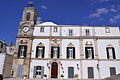
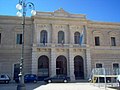
The architecture is typical of the region with an old Centro Storico (Historical Centre) containing white-washed, stone buildings with cool, shaded, cave-like interiors, narrow streets and churches. The town also features several community squares, each of which is built on the edge of the hill allowing for some spectacular landscapes.
In Cisternino and the surrounding area there have been several Bronze Age finds, including different types of hand tools. Evidence would suggest that the region was also a seasonal home to ancient hunter-gatherer humans.
Food
Broad beans purée with wild chicory (fave e cicorie selvatiche), orecchiette con braciole e polpette (a particular shape of pasta with tomato sauce, stuffed beef rolls and bread balls on the side to dip in the sauce at the end) and "bombette" (a type of roasted pork rolls) are three typical dishes of Cisternino cuisine.
Text from Wikipedia, the free encyclopedia, under CC BY-SA 4.0. Full article: «Cisternino».
Photos
Getting there
Cisternino CittaTrain, nearest
1.7 km as the crow flies
Cisternino
Aeroporto di Taranto-Grottaglie26.6 km
Distances are as the crow flies, not walking or driving.
Loading map…
Nearby
See on the mapMore historic villages in Puglia (Apulia)

- Most beautiful villages

- Most beautiful villages

- Most beautiful villages

- Most beautiful villages

- Most beautiful villages
Frequently asked questions
Where is Cisternino?
Cisternino is in Cisternino, in the province of Brindisi (Puglia (Apulia)), Italy. GPS coordinates: 40.75000, 17.41667.
What else is there to see near Cisternino?
Nearby you’ll find: Palazzo Lagravinese (1.3 km away), Ecomuseo della Valle d'Itria (7.4 km away), Palazzo della Corte (8.3 km away).
Sources and licences
Text. Wikipedia, the free encyclopedia (CC BY-SA 4.0).
Data. Wikidata (CC0); opening hours and contacts OpenStreetMap (ODbL).
Photos. Wikimedia Commons, author and licence on every image.
Credits for the 9 photos
- Veduta valle d itria cisternino — Kiuz, Public domain
- Antico cimitero cittadino Cisternino — Kiuz, CC BY-SA 3.0
- Arco antico Cisternino — Kiuz, Public domain
- Chiesa dei Santissimi Medici, Contrada Marinelli, Cisternino — Kiuz, CC BY-SA 4.0
- Cisternino - cimitero di Cisternino - 2026-09-29 15-52-49 001 — Franco52br, CC BY-SA 4.0
- Cisternino - Comune di Cisternino - 2023-09-25 16-56-33 001 — Acquario51, CC BY-SA 4.0
- Cisternino - Comune di Cisternino - 2023-09-26 19-03-15 001 — ANTONIO MARANGI, CC BY-SA 4.0
- Cisternino - Comune di Cisternino - 2023-09-26 19-04-13 001 — ANTONIO MARANGI, CC BY-SA 4.0
- Cisternino - Comune di Cisternino - 2023-09-26 19-05-51 001 — ANTONIO MARANGI, CC BY-SA 4.0
Updated 28 October 2026. All sources and licences