


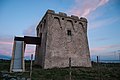


Photo: Marek93, CC BY-SA 3.0 · Wikimedia Commons
At a glance
- Type
- Historic village
- Elevation
- 26 m above sea level
- Area
- 49,070,000 m²
- Coordinates
- 40°19′22″ N, 17°34′25″ E
History and description
Maruggio (Brindisino: Marùggiu; Latin: Marubium) is a village and comune in the province of Taranto, Apulia, southeast Italy. The village is located in a natural depression 2 kilometres (1.2 mi) from the Gulf of Taranto, in the north-west part of Salento peninsula and it's one of the villages of South Italy where the Greek dialect Griko is spoken.
The nearest villages are Torricella at 6 kilometres (4 mi), Sava at 10 kilometres (6 mi), Manduria at 12 kilometres (7 mi) and Avetrana at 16 kilometres (10 mi). It is one of I Borghi più belli d'Italia ("The most beautiful villages of Italy").
Territory
The territory of Maruggio extends for 48.33 square kilometres (18.66 mi2) on a level land, with some low-rise hills in the north part of the territory, which reaches a maximum elevation of 101 metres (331 ft).
There are no rivers, except a little creek, the Canale del Curso, near Castigno, in the western part of Maruggio's territory.
The coast extends for 9.2 kilometres (5.7 mi), and it is mainly sandy but with rocky parts near Acquadolce Cirenaica and Monaco Mirante.
History
Maruggio was founded by Gorgolano, the Byzantine governor, with the union from the ancient hamlets of Castigno, Olivaro, Albano, Roselle and San Nicolò. After a period under the Knights Templar, from 1317 to 1819 it was ruled by the Knights of Malta. In 1819 it became an autonomous commune.
Text from Wikipedia, the free encyclopedia, under CC BY-SA 4.0. Full article: «Maruggio».
Photos
Getting there
ManduriaTrain, nearest
10.6 km as the crow flies
Maruggio
Aeroporto di Taranto-Grottaglie25.6 km
Distances are as the crow flies, not walking or driving.
Loading map…
Nearby
See on the mapMore historic villages in Puglia (Apulia)

- Most beautiful villages

- Most beautiful villages

- Most beautiful villages

- Most beautiful villages

- Most beautiful villages
Frequently asked questions
Where is Maruggio?
Maruggio is in Maruggio, in the province of Taranto (Puglia (Apulia)), Italy. GPS coordinates: 40.32278, 17.57361.
What else is there to see near Maruggio?
Nearby you’ll find: Convento di Santa Maria delle Grazie (2.8 km away), Torre Moline (2.9 km away), Torre Borraco (5.6 km away).
Sources and licences
Text. Wikipedia, the free encyclopedia (CC BY-SA 4.0).
Data. Wikidata (CC0); opening hours and contacts OpenStreetMap (ODbL).
Photos. Wikimedia Commons, author and licence on every image.
Credits for the 8 photos
- ChiesaMadreMaruggio — Marek93, CC BY-SA 3.0
- Atlante delle spiagge italiane - Foglio 213 Maruggio — Biblioteca Centrale del Consiglio Nazionale delle Ricerche, CC BY-SA 4.0
- Maruggio - Municipio di Maruggio - 2025-09-28 21-20-10 001 — Daniela_De_Blasi, CC BY-SA 4.0
- Maruggio - Municipio di Maruggio - 2025-09-28 21-20-50 001 — Daniela_De_Blasi, CC BY-SA 4.0
- Maruggio - Municipio di Maruggio - 2025-09-28 21-21-22 001 — Daniela_De_Blasi, CC BY-SA 4.0
- Maruggio - Municipio di Maruggio - 2025-09-28 21-21-50 001 — Daniela_De_Blasi, CC BY-SA 4.0
- Maruggio - Municipio di Maruggio - 2025-09-28 21-23-27 001 — Daniela_De_Blasi, CC BY-SA 4.0
- Maruggio, fine del centro abitato - panoramio — Umbria ws, CC BY-SA 3.0
Updated 28 October 2026. All sources and licences