


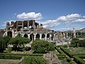


Archaeological site, Capua (CE)
41°06′34″ N, 14°12′33″ E
No photo on Wikimedia Commons yet
At a glance
- Type
- Archaeological site
- Coordinates
- 41°06′34″ N, 14°12′33″ E
About
Casilinum (Ancient Greek: Κασιλῖνον) was an ancient city of Campania, Italy, situated some 3 miles north-west of the ancient Capua. The position of Casilinum at the junction of the Via Appia and Via Latina, at their crossing of the river Volturnus by a still-existing three-arched bridge, gave the town considerable strategic importance during the Roman Republic.
Casilinum was located where the modern city of Capua now stands, while the ancient Capua was located on the site of the modern Santa Maria Capua Vetere.
While the original pre-Roman town, doubtless dependent on neighboring Capua, stood entirely on the left (south) bank surrounded on three sides by the river, the Roman city extended to the right bank also. Remains of this later town have been found at some 25 feet below the modern ground-level, the river-bed having since risen considerably.
During the Second Punic War, Casilinum was first occupied by Quintus Fabius Maximus Verrucosus in 217 BCE.
Text from Wikipedia, the free encyclopedia, under CC BY-SA 4.0. Full article: «Casilinum».
Getting there
CapuaTrain, nearest
900 m as the crow flies
Casilinum
Aeroporto di Napoli Capodichino26.0 km
Distances are as the crow flies, not walking or driving.
Loading map…
Nearby
See on the mapDo you know this place?
We are missing the opening hours and photos. The data comes from open projects: if you add it there, it appears here at the next update.
More archaeological sites in Campania

- UNESCO
- Free 1st Sunday

- UNESCO

- UNESCO

- UNESCO
- Free 1st Sunday

- Free 1st Sunday
Frequently asked questions
Where is Casilinum?
Casilinum is in Capua, in the province of Caserta (Campania), Italy. GPS coordinates: 41.10940, 14.20910.
What else is there to see near Casilinum?
Nearby you’ll find: Porta di Capua (100 m away), Palazzo Fieramosca (300 m away), Campanian Provincial Museum of Capua (400 m away).
Sources and licences
Text. Wikipedia, the free encyclopedia (CC BY-SA 4.0).
Data. Wikidata (CC0); opening hours and contacts OpenStreetMap (ODbL).
Photos. Wikimedia Commons, author and licence on every image.
Credits for the 1 photos
- Via appia Nardelli 1.3 — Bellisario2000, Public domain
Updated 28 October 2026. All sources and licences