




- UNESCO
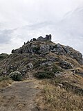
Photo: Clemensfranz, CC BY 2.5 · Wikimedia Commons
Tindari, ancient Tyndaris (Ancient Greek: Τυνδαρίς, Strab.) or Tyndarion (Τυνδάριον, Ptol.), is a small town, frazione (suburb or municipal component) in the comune of Patti and a Latin Catholic titular see.
The monumental ruins of ancient Tyndaris are a main attraction for visitors and excavations are continuing to reveal more parts of the city.
Tindari has a famous sanctuary and is also famous for the poem Vento a Tindari, written by Salvatore Quasimodo.
Ancient Tyndaris was strategically situated on its prominent hill overlooking the wide bay of the Tyrrhenian Sea bounded by the Capo di Milazzo on the east, and the Capo Calavà on the west. It was connected by a comparatively narrow isthmus with the lower ground inland. It thus commanded views of the summit of Mount Etna and northwards to the Lipari Islands.
It was one of the latest of all the cities in Sicily that could claim a purely Greek origin, having been founded by the elder Dionysius in 396 or 395 BC in Magna Graecia; the site is so strategic that it is a surprise it was not occupied earlier. The original settlers were the remains of the Messenian exiles, who had been driven from Naupactus, Zacynthus, and the Peloponnese by the Spartans after the close of the Peloponnesian War. These had at first been established by Dionysius at Messana, when he repeopled that city; but the Spartans having taken umbrage at this, he transferred them to the site of Tyndaris, which had previously been included in the territory of Abacaenum. The colonists themselves gave to their new city the name of Tyndaris, from their native divinities, the "Tyndaridae" or Dioscuri, and readily admitting fresh citizens from other quarters, soon raised their whole population to the number of 5000 citizens. The new city thus rose at once to be a place of considerable importance. …
By the 19th century, the site of Tyndaris was wholly deserted, but the name was retained by a church, which crowned the most elevated point of the hill on which the city formerly stood, and was still called the Madonna di Tindaro. It is c. 180 m above the sea-level, and forms a conspicuous landmark to sailors. Considerable ruins of the ancient city, are also visible. It occupied the whole plateau or summit of the hill, and the remains of the ancient walls may be traced, at intervals, all round the brow of the cliffs, except in one part, facing the sea, where the cliff is now quite precipitous. It is not improbable that it is here that a part of the cliff fell in, in the manner recorded by Pliny Two gates of the city are also still distinctly to be traced.
The chief monuments, of which the ruins are still extant within the circuit of the walls, are:
the theatre, of which the remains are in imperfect condition, but sufficient to show that it was not of large size, and apparently of Roman construction, or at least, like that of Tauromenium, rebuilt in Roman times upon the Greek foundations
a propylaeum with two handsome stone arches (previously called a Gymnasium)
several other edifices of Roman times, but of wholly uncertain character, a mosaic pavement and some Roman tombs.
Numerous inscriptions, fragments of sculpture, and architectural decorations, as well as coins, vases etc. have also been discovered on the site.
Local legend tells that the lagoon was created after a pilgrim who came to see the Madonna refused to pray to the Madonna because she was black. The woman accidentally dropped her baby into the ocean and the Madonna made the land rise to save the baby. The sands of Marinello have taken shape of the profile of the Madonna.
Text from Wikipedia, the free encyclopedia, under CC BY-SA 4.0. Full article: «Tindari».
Distances are as the crow flies, not walking or driving.


Tindari is in Patti, in the province of Messina (Sicily), Italy. GPS coordinates: 38.14556, 15.03972.
Nearby you’ll find: Greek Theatre of Tindari (300 m away), Area archeologica di Tindari (400 m away), Castello di Oliveri (3 km away).
Text. Wikipedia, the free encyclopedia (CC BY-SA 4.0).
Data. Wikidata (CC0); opening hours and contacts OpenStreetMap (ODbL).
Photos. Wikimedia Commons, author and licence on every image.
Updated 28 October 2026. All sources and licences