



- UNESCO
- Free 1st Sunday
Archaeological site, Rome (RM)
41°53′22″ N, 12°29′05″ E
No photo on Wikimedia Commons yet
Archaeological site
An ancient Roman temple on the Palatine Hill in Rome, possibly dating from as early as 338 BC
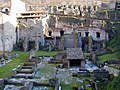
The Temple of Juno Sospita ("Savior") was an ancient Roman temple on the Palatine Hill in Rome, possibly dating from as early as 338 BC.
It was probably a term for a small shrine adjoining the Temple of the Magna Mater (recorded by Ovid), parts of which remain in Augustan-era opus reticulatum, although most of the remains belong to a Hadrianic restoration.
A minority interpretation is that 'Temple of Juno Sospita' was another term for the Temple of the Magna Mater's auguraculum.
Text from Wikipedia, the free encyclopedia, under CC BY-SA 4.0. Full article: «Temple of Juno Sospita».
Distances are as the crow flies, not walking or driving.
We are missing the opening hours and photos. The data comes from open projects: if you add it there, it appears here at the next update.


Temple of Juno Sospita is in Rome, in the province of Roma (Lazio), Italy. GPS coordinates: 41.88956, 12.48461.
Nearby you’ll find: Temple of Cybele (0 m away), Casa Romuli (0 m away), Temple of Victory (0 m away).
Text. Wikipedia, the free encyclopedia (CC BY-SA 4.0).
Data. Wikidata (CC0); opening hours and contacts OpenStreetMap (ODbL).
Photos. Wikimedia Commons, author and licence on every image.
Updated 28 October 2026. All sources and licences