




- UNESCO
- Free 1st Sunday
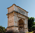
Photo: fr:User:ColdEel & edited by nl:Gebruiker:Joris1919, CC BY-SA 4.0 · Wikimedia Commons
Archaeological site
A porticus near the Sacra Via in Ancient Rome
The Porticus Margaritaria (Latin for the "Pearl-Sellers' Portico") was a portico in ancient Rome known only from the Notitia et Curiosum. The complex was seemingly commercial in nature as numerous inscriptions refer to jewelers (CIL VI.9207, 9221, 9239, 9418, 9419). It was most likely located outside of the Forum Romanum and adjacent to the House of Vestals. Directly across the Sacra Via was the Basilica Nova. To its south-east was the Temple of Venus and Roma and beyond that the Colosseum. Nothing remains of the Porticus Margaritaria except for some sections of foundation and ruins. Jordan (I.2.476) placed the porticus on the boundary of Region VIII, between the Forum Boarium and the Forum Holitorium.
Text from Wikipedia, the free encyclopedia, under CC BY-SA 4.0. Full article: «Porticus Margaritaria».
Distances are as the crow flies, not walking or driving.


Porticus Margaritaria is in Rome, in the province of Roma (Lazio), Italy. GPS coordinates: 41.89111, 12.48778.
Nearby you’ll find: Palatine Museum (0 m away), Temple of Isis (0 m away), Horrea Piperataria (100 m away).
Text. Wikipedia, the free encyclopedia (CC BY-SA 4.0).
Data. Wikidata (CC0); opening hours and contacts OpenStreetMap (ODbL).
Photos. Wikimedia Commons, author and licence on every image.
Updated 28 October 2026. All sources and licences