


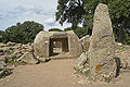


- UNESCO
Archaeological site, Villasalto (SU)
39°28′43″ N, 9°27′14″ E
No photo on Wikimedia Commons yet
Our data shows no stations, stops or car parks nearby. Check how to get there before you set out.
 Things to see in Villasalto954 inhabitants, 502 m above sea level. 5 historic places in the town.PhotoNo machine-readable author provided. Pupina assumed (based on copyright claims)., Public domain5 places
We are missing the opening hours, a description and photos. The data comes from open projects: if you add it there, it appears here at the next update.


Nuraghe Serra Madau Villasalto is in Villasalto, in the province of Sud Sardegna (Sardinia), Italy. GPS coordinates: 39.47856, 9.45391.
Nearby you’ll find: Necropolis of Pranu Narbonis (9.1 km away), Sassai Castle (12.6 km away), Castello di Quirra (14 km away).
Data. Wikidata (CC0); opening hours and contacts OpenStreetMap (ODbL).
Updated 28 October 2026. All sources and licences