






- UNESCO
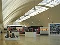
Photo: Daniela Serra (Cagliari), CC BY-SA 3.0 · Wikimedia Commons
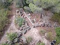
Monte Sirai is an archaeological site near Carbonia, in the province of South Sardinia, Sardinia, Italy. It is a settlement built at the top of a hill by the Phoenicians of Sulci (today's Sant'Antioco). The history of studies in Monte Sirai has a very precise date: the fall of 1962, when a local boy casually found a female figure carved on a stele of the tophet. Following further inspections, in August 1963, the local Soprintendenza and the Institute of Near Eastern Studies of the Sapienza University of Rome started excavations, leading to a fairly comprehensive study of the entire town.
Given the excellent location of the hill, the site was inhabited since the Neolithic age. Some nuragic towers witness an important anthropization in the first half of the II millennium BC. The first Phoenician records date back to 730 BC circa, at the same time of other coastal cities of Sardinia. The town is built around the so-called mastio, a sacred place that undergone several renovations, perhaps with defensive function. The discovery of a statue of the goddess Astarte (now in the National Museum of Cagliari), discovered in 1964, confirms a use of religious type.
The town was affected by the Carthaginian conquest in the 6th century BC. A dozen new families settled subsequently in Monte Sirai, as witnessed by many hypogeum-tombs of Punic types; the rite of cremation, prevalent during the Phoenician period, was substituted by the entombment. The city wall was strengthened around 375 BC, roughly the period of appearance of the first local tophet. A subsequent restoration of the fortifications was carried out after the First Punic War; under the Roman rule all the military facilities were dismantled. Around 110 BC the site was inexplicably abandoned. Subsequent frequentations are witnessed by some Constantinian era coins found in the tophet area.
Text from Wikipedia, the free encyclopedia, under CC BY-SA 4.0. Full article: «Monte Sirai».
Distances are as the crow flies, not walking or driving.


Monte Sirai is in Carbonia, in the province of Sulcis Iglesiente (Sardinia), Italy. Address: Carbonia. GPS coordinates: 39.18012, 8.48612.
According to OpenStreetMap the opening hours are: Tuesday to Sunday: 10:00–18:00; Monday: Closed. Always check the official website before your visit.
Nearby you’ll find: Nuraghe Sirai (1.4 km away), Santa Maria (1.5 km away), Serbariu coal mine museum (3 km away).
Text. Wikipedia, the free encyclopedia (CC BY-SA 4.0).
Data. Wikidata (CC0); opening hours and contacts OpenStreetMap (ODbL).
Photos. Wikimedia Commons, author and licence on every image.
Updated 28 October 2026. All sources and licences