






- UNESCO
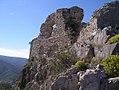
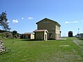
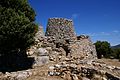
Photo: Damiano Rossi, CC BY-SA 3.0 · Wikimedia Commons
Opening hours and directions are on this page. The full story is on Italian Wikipedia.
Read it in ItalianOur data shows no stations, stops or car parks nearby. Check how to get there before you set out.


Nuraghe S'Ulimu is in Ulassai, in the province of Nuoro (Sardinia), Italy. GPS coordinates: 39.65420, 9.57290.
According to OpenStreetMap data, the site is not wheelchair accessible.
Nearby you’ll find: Is Pirois sacred well (10.1 km away), Castello di Quirra (14 km away), Nuraghe Pranu (18 km away).
Data. Wikidata (CC0); opening hours and contacts OpenStreetMap (ODbL).
Photos. Wikimedia Commons, author and licence on every image.
Updated 28 October 2026. All sources and licences