



- UNESCO
Photo: MrAndre, CC BY-SA 3.0 · Wikimedia Commons
Archaeological site
10th-18th Century Italian nuragic complex
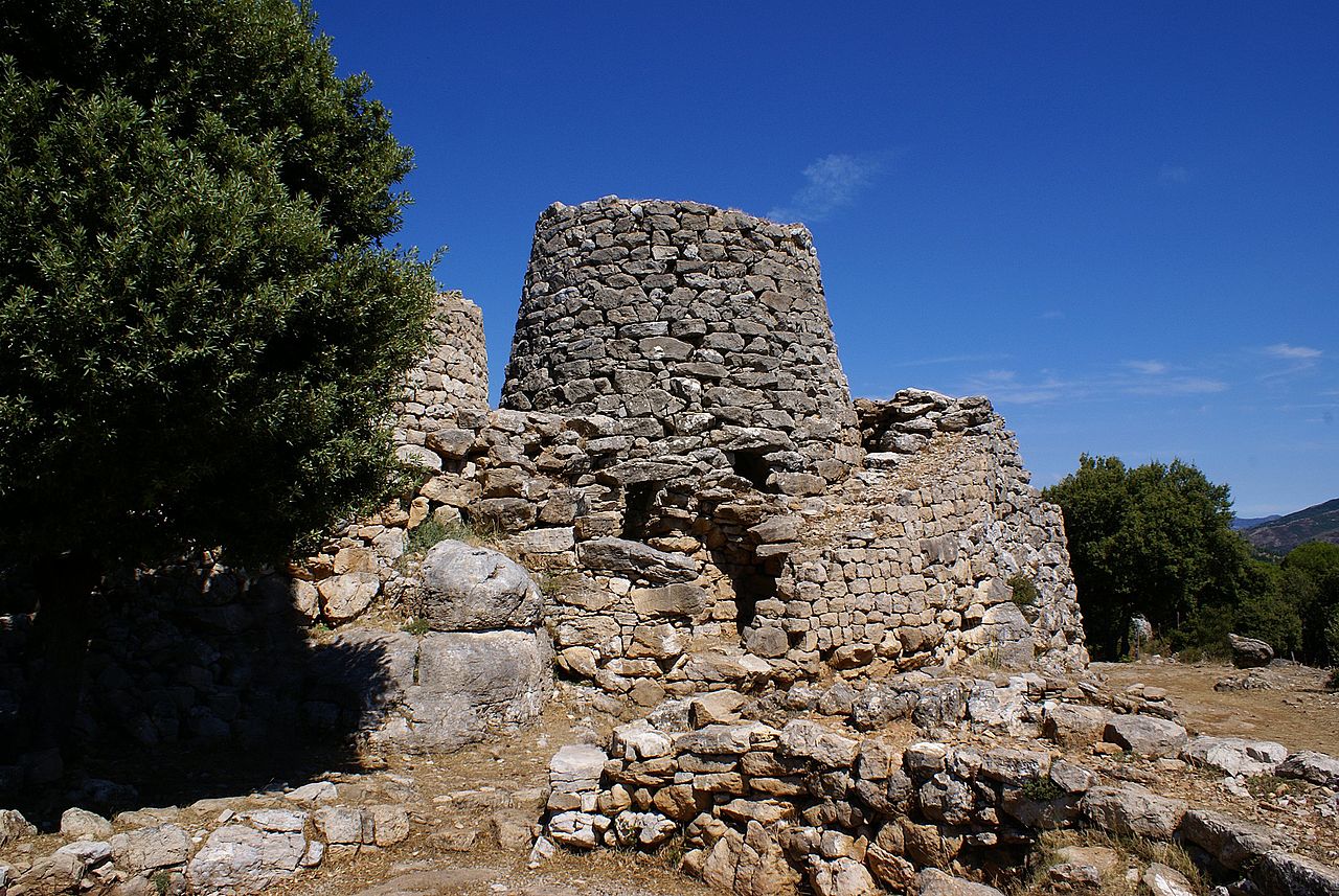
The nuraghe Serbissi is a nuragic complex dating back to 18th-10th century BC.
The site is located on a limestone plateau between the towns of Osini and Gairo. The nuragic complex, built over a cave with two entrances, consists of a central tower of 6.3m high flanked by three smaller towers, around which are placed 8 circular huts. Access to the towers is through a small courtyard.
The complex was used from the Early Bronze Age to the Late Bronze Age.
Text from Wikipedia, the free encyclopedia, under CC BY-SA 4.0. Full article: «Nuraghe Serbissi».
Distances are as the crow flies, not walking or driving.


Nuraghe Serbissi is in Osini, in the province of Nuoro (Sardinia), Italy. Address: Osini. GPS coordinates: 39.84500, 9.46111.
Nearby you’ll find: Stazione dell'arte (4.4 km away), Museo all'aperto Maria Lai (5 km away), Area of Selene (6.2 km away).
Text. Wikipedia, the free encyclopedia (CC BY-SA 4.0).
Data. Wikidata (CC0); opening hours and contacts OpenStreetMap (ODbL).
Photos. Wikimedia Commons, author and licence on every image.
Updated 28 October 2026. All sources and licences