




- UNESCO
Photo: CC BY-SA 3.0 · Wikimedia Commons
Archaeological site
Nuraghe in Orroli, Sardinia, Italy
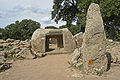
The Nuraghe Arrubiu is one of the largest nuraghes in Sardinia. It is in Orroli, in the province of South Sardinia. Its name means "red nuraghe" in Sardinian, which derives from the basalt stones it had been built with.
The settlement was built during the 15th century BC; the main tower originally reached a height of between 25 and 30 metres, making it one of the tallest structures in Bronze Age Europe. The main structure, which is made up of five towers, is protected by two secondary walls, making a total of 21 towers. The area covered by the complex is around 3,000 square metres.
The nuraghe was also provided with a complex drainage system that provided the cistern with water.
Text from Wikipedia, the free encyclopedia, under CC BY-SA 4.0. Full article: «Nuraghe Arrubiu».
Distances are as the crow flies, not walking or driving.


Nuraghe Arrubiu is in Orroli, in the province of Sud Sardegna (Sardinia), Italy. Address: Orroli. GPS coordinates: 39.66219, 9.29762.
According to OpenStreetMap the opening hours are: Every day: 9:30–sunset. Always check the official website before your visit.
Nearby you’ll find: Dòmu d’Urxia (9.9 km away), Funtana Coberta (10.1 km away), Necropolis of Pranu Muttedu (10.8 km away).
Text. Wikipedia, the free encyclopedia (CC BY-SA 4.0).
Data. Wikidata (CC0); opening hours and contacts OpenStreetMap (ODbL).
Photos. Wikimedia Commons, author and licence on every image.
Updated 28 October 2026. All sources and licences