





- UNESCO
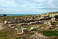
Photo: Figiu, CC BY-SA 3.0 · Wikimedia Commons
Archaeological site
Archaeological site in the Italian comune of Ribera in the province of Agrigento in Sicily
The Anguilla necropolis (Italian: necropolis Anguilla) is an archaeological site in the Italian comune of Ribera in the province of Agrigento in Sicily.
The necropolis dates from the middle and late Bronze Age (13th century BC) and was discovered in 1982. It is located to the south of the town of Ribera.
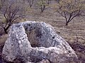
It consists of two types of tombs: artificial caves and chambers. Some are accessed through a 1.5-5 metre long corridore called a "dromos", located in front of the tomb itself. The tombs consist of one or two chambers with a corbel vaulted dome (tholos) containing a platform with the corpse and votive offerings (vases, rings, arms, tools) on it.
The dimensions and typology of these tombs are unique in western Sicily.
Text from Wikipedia, the free encyclopedia, under CC BY-SA 4.0. Full article: «Anguilla necropolis».
Our data shows no stations, stops or car parks nearby. Check how to get there before you set out.


Anguilla necropolis is in Ribera, in the province of Agrigento (Sicily), Italy. GPS coordinates: 37.47232, 13.25446.
Nearby you’ll find: Castello di Poggiodiana (4.3 km away), Theatre of Herakleia Minoa (9 km away), Heraclea Minoa (9 km away).
Text. Wikipedia, the free encyclopedia (CC BY-SA 4.0).
Data. Wikidata (CC0); opening hours and contacts OpenStreetMap (ODbL).
Photos. Wikimedia Commons, author and licence on every image.
Updated 28 October 2026. All sources and licences