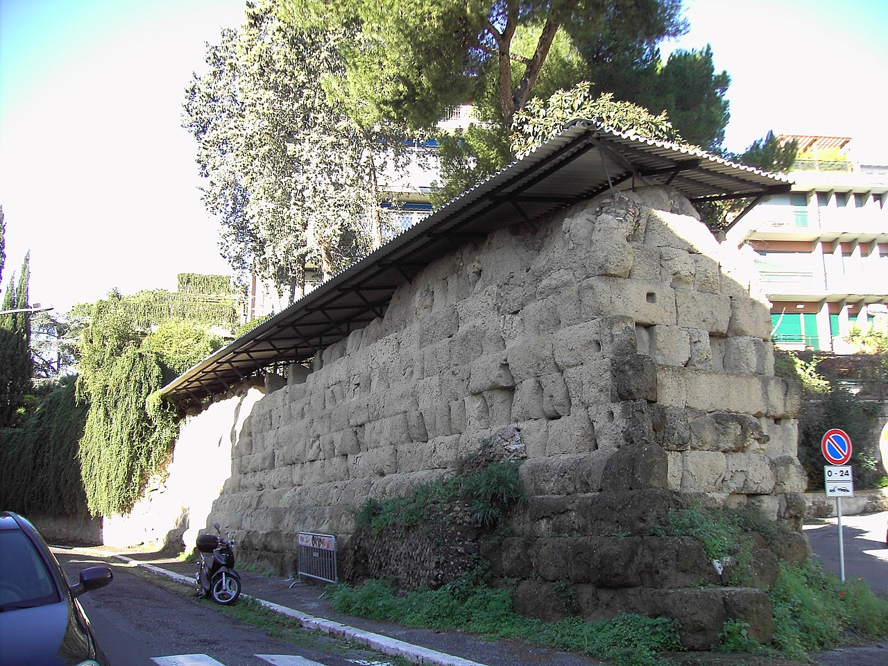


Photo: Lalupa, CC BY-SA 3.0 · Wikimedia Commons
Fortress / Tower, 4th century BC
Servian Wall
Defensive barrier around the ancient city of Rome
- Within the UNESCO World Heritage Site “Historic Centre of Rome, the Properties of the Holy See in that City Enjoying Extraterritorial Rights and San Paolo Fuori le Mura”
At a glance
- Type
- Fortress / Tower
- Period
- Antiquity, 4th century BC
- Materials
- Tuff
- Coordinates
- 41°54′06″ N, 12°30′06″ E
History and description
The Servian Wall (Latin: Murus Servii Tullii; Italian: Mura Serviane) is an ancient Roman defensive barrier constructed around the city of Rome in the early 4th century BC. The wall was built of volcanic tuff and was up to 10 m (33 ft) in height in places, 3.6 m (12 ft) wide at its base, 11 km (6.8 mi) long, and is believed to have had 16 main gates, of which only one or two have survived, and enclosed a total area of 246 hectares (610 acres). In the 3rd century AD it was superseded by the construction of the larger Aurelian Walls as the city of Rome grew beyond the boundary of the Servian Wall.
History
The wall is named after the sixth Roman King, Servius Tullius. The literary tradition stating that there was some type of defensive wall or earthen works that encircled the city of Rome dating to the 6th century BC has been found to be false. The main extent of the Servian Wall was built in the early 4th century BC, during what is known as the Roman Republic.
Construction
The Servian Wall was originally built from large blocks of Cappellaccio tuff (a volcanic rock made from ash and rock fragments that are ejected during a volcanic eruption) that was quarried from the Alban Hills volcanic complex. This initial wall of Cappellaccio tuff was partially damaged and in need of restoration by the late 390s (either because of rapid disintegration or damage sustained after the Sack of Rome in 390 BC). These reparations were done using the superior Grotta Oscura tuff which had become available after the Romans had defeated Veii in the 390s. This tuff was quarried by the vanquished Veientines. In addition to the tuff blocks, some sections of the structure incorporated a deep fossa, or a ditch, in front of the wall, as a means to effectively heighten the wall. This second iteration of the wall containing Grotta Oscura tuff is dated by Livy to have been completed in 378 BC.
Along part of the topographically weaker Northern perimeter was an agger, a defensive ramp of earth that was built up along the inside of the Servian Wall. This effectively thickened the wall and also gave the defenders of Rome a base to stand while repelling an attack. The wall was also outfitted with defensive war engines, including catapults.
Usage
The Servian Wall was maintained through the end of the Late Republic and into the Roman Empire. By this time, Rome had already begun to outgrow the original boundaries of the Servian Wall.
The Servian Wall became unnecessary as Rome became well protected by the ever-expanding strength of the field armies of the Republic and of the later Empire. As the city continued to grow and prosper, Rome was essentially without a border wall for the first three centuries of the Empire. Expanding domestic structures simply incorporated existing wall sections into their foundations, an example of which survives in the Auditorium of Maecenas. When German tribes made further incursions along the Roman frontier in the 3rd century AD, Emperor Aurelian had the larger Aurelian Walls built to protect the city of Rome.
Present day
Several sections of the Servian Wall are still visible in various locations around the city of Rome. The largest section is preserved outside the Termini Station, the main railway station in Rome – including a section in a McDonald's dining area at the station. Another notable section on the Aventine Hill incorporates an arch that was supposedly for a defensive catapult from the late Republic.
Text from Wikipedia, the free encyclopedia, under CC BY-SA 4.0. Full article: «Servian Wall».
Timeline
- 4th century BCBuilt
Events and people from Wikidata (CC0).
Photos
Getting there
Roma TerminiTrain, nearest
100 m as the crow flies
Servian Wall
Aeroporto di Roma-Ciampino13.7 km
Distances are as the crow flies, not walking or driving.
Loading map…
Nearby
See on the mapMore fortresses and towers in Lazio


- UNESCO


Frequently asked questions
Where is Servian Wall?
Servian Wall is in Rome, in the province of Roma (Lazio), Italy. GPS coordinates: 41.90167, 12.50167.
How old is Servian Wall?
Wikidata dates it to the 4th century BC.
What else is there to see near Servian Wall?
Nearby you’ll find: Porta Viminale (100 m away), Museum Palazzo Massimo alle Terme (300 m away), Museo Nazionale Romano (300 m away).
Sources and licences
Text. Wikipedia, the free encyclopedia (CC BY-SA 4.0).
Data. Wikidata (CC0); opening hours and contacts OpenStreetMap (ODbL).
Photos. Wikimedia Commons, author and licence on every image.
Credits for the 9 photos
- Ripa - le mura a via di sant anselmo 051211-06 — Lalupa, CC BY-SA 3.0
- Esquilino - mura serviane all'auditorium 1120875 — Lalupa, CC BY-SA 3.0
- Monti - mura serviane a Magnanapoli 1010002 — Lalupa, CC BY-SA 3.0
- S Sabina mura serviane 1150186 — Lalupa, CC BY-SA 3.0
- S Sabina mura serviane cisterna 1150183 — Lalupa, CC BY-SA 3.0
- Sallustiano - mura serviane a via Salandra 01702 — Lalupa, CC BY-SA 3.0
- Le mura di Servio (xilografia) — Unknown author Unknown author, Public domain
- Ripa - le mura a via di sant anselmo arco a porta raudusculana 051211-08 — Lalupa, CC BY-SA 3.0
- Termini intérieur - muraille Servienne — Joël Thibault, CC BY-SA 4.0
Updated 28 October 2026. All sources and licences