At a glance
- Coordinates
- 41°45′16″ N, 12°17′13″ E
About
No English description yet
Opening hours and directions are on this page. The full story is on Italian Wikipedia.
Read it in ItalianGetting there
Parco LeonardoTrain, nearest
5.1 km as the crow flies
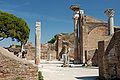
Horrea Epagathiana et Epaphrodithiana
Aeroporto di Roma-Fiumicino7.4 km
Distances are as the crow flies, not walking or driving.
More archaeological sites in Lazio
Archaeological site, 82 AD Rome (RM)
Opening hours
Archaeological site, 216 AD Rome (RM)
Opening hours
Archaeological site, 7th century BC Fiumicino (RM)
Opening hours
Archaeological site, 100s Rome (RM)
Opening hours
Archaeological site, 80s Rome (RM)
Opening hours
Archaeological site Ciampino (RM)
Opening hours
See all archaeological sites in Lazio
Things to see in Rome: 1372 historic places
Frequently asked questions
Where is Horrea Epagathiana et Epaphrodithiana?
Horrea Epagathiana et Epaphrodithiana is in Rome, in the province of Roma (Lazio), Italy. GPS coordinates: 41.75433, 12.28697.
What else is there to see near Horrea Epagathiana et Epaphrodithiana?
Nearby you’ll find: Terme di Buticoso (0 m away), Ostia (0 m away), Piccolo Mercato (100 m away).
Sources and licences
Data. Wikidata (CC0); opening hours and contacts OpenStreetMap (ODbL).
Photos. Wikimedia Commons, author and licence on every image.
Credits for the 9 photos
- Ostia, horrea epagathiana 02 — Sailko, CC BY 3.0
- Horrea Epagathiana Ostia Antica 2006-09-08 — Marie-Lan Nguyen ( User:Jastrow ), CC BY 2.5
- Horrea Epagathiana, Ostia Antica — Luca.mussi 90, CC BY-SA 3.0
- Horrea Epagathiana — Livioandronico2013, CC BY-SA 3.0
- Ostia Antica - R1 via degli Horrea Epagathiana P1110068 — Lalupa, CC BY-SA 4.0
- Ostia, horrea epagathiana 01 — Sailko, CC BY 3.0
- Italy-0394 (5159101019) — Dennis G. Jarvis, CC BY-SA 2.0
- Ostia Antica 2013-03-08-53 — Szilas, Public domain
- Ostia antica-17 — Patrick Denker, CC BY 2.0
Updated 28 October 2026. All sources and licences
Spotted a mistake? Fix it on OpenStreetMap