
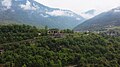


Photo: K.u.k. Kriegspressequartier, Lichtbildstelle - Wien, Public domain · Wikimedia Commons
At a glance
- Type
- Fortress / Tower
- Period
- Modern era, 1906
- Protection
- Italian national heritage
- Coordinates
- 45°59′59″ N, 11°41′17″ E
- Address
- Via Cima Campo
History and description
Fort Leone, also known as Fort Cima Campo, is an Italian fortification built on the peak of Col di Campo at an elevation of 1512m (5,000ft). Fort Leone is so high it practically overlooks the Valsugana Valley, which was on the other side of the border when the fort was built. The fort was built between 1904 and May 1915, and is what is called an “Armored Fort” meaning it was reinforced with steel and concrete. Leone is located 15km from the town of Arsiè.
Construction
Fort Leone had a moat that surrounded the whole fort, and a sliding bridge regulated access. The fort was equipped with drainage and air purification systems, which made it one of the most modern Italian fortifications of the time. The fort was built in two sections: the six 149mm howitzers made up the upper battery, while the lower battery formed the main part of the fort. Deep underground there was a set of tracks used to move ammunition to the guns, in addition to ammo hoists up to the guns. Despite being an “Armored Fort”, Leone was built mostly out of bricks and stone.
World War I
Between the end of 1915 and 1916, Fort Leone was disarmed due to inactivity, and its guns were replaced by black logs. By 1917, it had become a warehouse and accommodation for Italian troops destined for the front lines. After the Battle of Caporetto, one of the gun housings was blown up after the gun had been removed. The Alpini battalion “Monte Pavione” occupied the fort and held off the Austrian advance for 2 days, helping the Italian lines stabilize of Monte Grappa. Eager to avoid more bloodshed, Major Olmi of the Alpini battalion “Monte Pavione”, 7th Alpini regiment, communicated his want to surrender Fort Leone to an Austrian officer of the 164th Landsturm. At 5pm on Nov. 12, 1917, Fort Leone was occupied by the Austrian 1st Alpine Brigade, taking Major Olmi, 12 officers, and 300 men prisoner.
Post-war to today
Access to Fort Leone has been restricted for many years due to the risk of collapse within the fort. Today, the fort has been restored by the municipality of Arsiè, with help from the Region of Veneto.
Text from Wikipedia, the free encyclopedia, under CC BY-SA 4.0. Full article: «Forte Leone».
Timeline
- 1906Built
Events and people from Wikidata (CC0).
Photos
Getting there
Tezze di GrignoTrain, nearest
1.8 km as the crow flies
Forte LeoneVia Cima Campo
Distances are as the crow flies, not walking or driving.
Loading map…
Nearby
See on the mapMore fortresses and towers in Veneto


Frequently asked questions
Where is Forte Leone?
Forte Leone is in Arsiè, in the province of Belluno (Veneto), Italy. Address: Via Cima Campo. GPS coordinates: 45.99967, 11.68817.
How old is Forte Leone?
Wikidata dates it to 1906.
What else is there to see near Forte Leone?
Nearby you’ll find: Forte Tagliata delle Fontanelle (4.1 km away), Tagliata della Scala (4.2 km away), Forte Coldarco (4.7 km away).
Sources and licences
Text. Wikipedia, the free encyclopedia (CC BY-SA 4.0).
Data. Wikidata (CC0); opening hours and contacts OpenStreetMap (ODbL).
Photos. Wikimedia Commons, author and licence on every image.
Credits for the 4 photos
- Cima di Campo.Tags zuvor erobertes italienisches Werk. (BildID 15635255) — K.u.k. Kriegspressequartier, Lichtbildstelle - Wien, Public domain
- Forte Leone (caserma) — Paolaro90, CC BY-SA 3.0
- Cima di Campo. Die Panzerkuppe vom Werk Leone. (BildID 15635353) — K.u.k. Kriegspressequartier, Lichtbildstelle - Wien, Public domain
- Oberhalb Werk Cima di Campo.Totalansicht. (BildID 15635262) — K.u.k. Kriegspressequartier, Lichtbildstelle - Wien, Public domain
Updated 28 October 2026. All sources and licences