


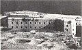

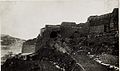


Photo: anonymous photographer during World War I, Public domain · Wikimedia Commons
Fortress / Tower
Forte Sebastiano
Austro-Hungarian fortification in the Southern Trentino
Folgaria (TN), Trentino-South Tyrol
At a glance
- Type
- Fortress / Tower
- Period
- Modern era, 1911
- Coordinates
- 45°54′55″ N, 11°13′44″ E
History and description
Fort Sebastiano, also known as Fort Cherle, was an Austro-Hungarian fortification built between the municipalities of Lavarone and Folgaria. Sebastiano was built between 1909 and 1914, and was one of the newest and most up to date fortifications in the Austro-Hungarian Empire when Italy declared war in May 1915. Sebastiano was built at an altitude of 1,445m on the mountain of Malga Cherle. The building is in a giant triangle shape, with the side facing the Italians left uncovered by earth so that additional cannons could be fitted to cover the approaches of the fort.
World War I
When Italy declared war on May 24, 1915, Fort Sebastiano had just been finished being built.
From 7-8pm on May 25, 1915, the fort was shelled by Italian 28 cm guns near the Italian Forte Compolongo. The next day, Sebastiano was hit by 9 28 cm shells. In 1915, Sebastiano fired its guns in support of the Austro-Hungarian Spring Offensive, which ultimately pushed the Italian batteries back out of range of Sebastiano. At the end of hostilities in Nov. 1918, the fort was occupied by Italian infantry, because the Austrians had quietly abandoned Sebastiano. Unlike some other forts of its group, Sebastiano was never attacked by Italian infantry.
Post-war to today
Fort Sebastiano was decommissioned from the Royal Army on Dec. 8, 1927. As of Jan. 1, 1931, the fort was rented by the Municipality of Folgaria for 29 years. However, as of May 5, 1935, the fort has been owned by the Municipality of Folgaria. After the fort had been bought, the fort was reduced to what we can see today by salvagers who dynamited the fort to extract the steel within.
Text from Wikipedia, the free encyclopedia, under CC BY-SA 4.0. Full article: «Forte Sebastiano».
Timeline
- 1911Built
Events and people from Wikidata (CC0).
Photos
Getting there
CaldonazzoTrain, nearest
9.6 km as the crow flies
Forte Sebastiano
Distances are as the crow flies, not walking or driving.
Loading map…
Nearby
See on the mapMore fortresses and towers in Trentino-South Tyrol


Frequently asked questions
Where is Forte Sebastiano?
Forte Sebastiano is in Folgaria, in the province of Trento (Trentino-South Tyrol), Italy. GPS coordinates: 45.91528, 11.22889.
How old is Forte Sebastiano?
Wikidata dates it to 1911.
What else is there to see near Forte Sebastiano?
Nearby you’ll find: Forte Sommo Alto (3.4 km away), Base Tuono (4.4 km away), Forte Belvedere-Gschwendt (4.6 km away).
Sources and licences
Text. Wikipedia, the free encyclopedia (CC BY-SA 4.0).
Data. Wikidata (CC0); opening hours and contacts OpenStreetMap (ODbL).
Photos. Wikimedia Commons, author and licence on every image.
Credits for the 6 photos
- Kehle Sebastiano — anonymous photographer during World War I, Public domain
- Forte Cherle oggi — Llorenzi, CC BY-SA 3.0
- Forte Sebastiano - panoramio - Jiří Příplata — Jiří Příplata, CC BY-SA 3.0
- Forte Sebastiano - panoramio — Jiří Příplata, CC BY-SA 3.0
- Forte Sebastiano 01 — Syrio, CC BY-SA 4.0
- Werk Sebastiano — anonymous photographer during World War I, Public domain
Updated 28 October 2026. All sources and licences