


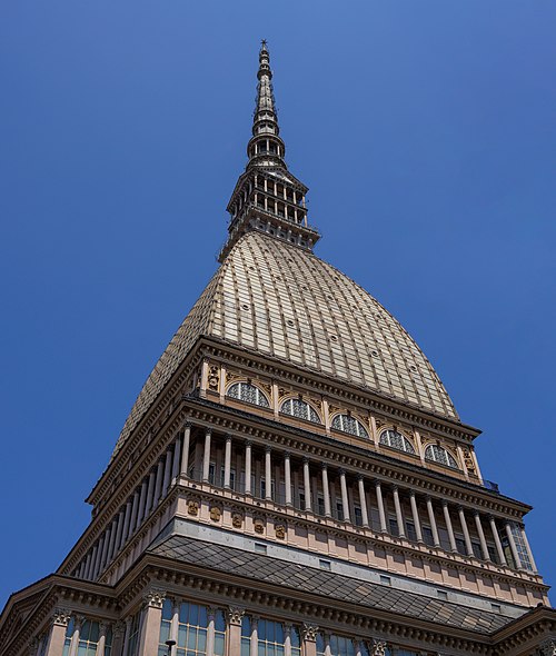
Photo: brigante mandrogno, Public domain · Wikimedia Commons
Fortress / Tower, 1732
Cittadella of Alessandria
Fortification in Alessandria, Italy
Alessandria (AL), Piedmont
At a glance
- Type
- Fortress / Tower
- Period
- Early modern period, 1732
- Commissioned by
- Kingdom of Sardinia
- Materials
- Brick
- Protection
- Tentative World Heritage Site
- Coordinates
- 44°55′18″ N, 8°36′17″ E
- Address
- Via Pavia, 2
History and description
The Cittadella of Alessandria (Italian: Cittadella di Alessandria) is a star fort and citadel in the city of Alessandria, Italy. It was built in the 18th century by the Kingdom of Sardinia, and today it is one of the best preserved fortifications of that era. It is one of the few fortifications in Europe still in their original environment, since there are no buildings blocking the views of the ramparts, or a road that surrounds the ditches.
On 10 March 1821, during the Piedmont insurrection, the blue, red and black tricolour of the Carbonari was raised on the Cittadella's bastions by Colonel Ansaldi. This was the first use of a tricolour flag in the history of Italy.
The Cittadella has been Italy's tentative list of UNESCO World Heritage Sites since 2006.
Location
The fortress lies across the river Tanaro in the north-west side of the city of Alessandria. The site is one of the lowest in the Piedmont region with an altitude of about 90 metres (300 ft) above sea-level.
History
Since its foundation, 1168, the town of Alessandria was always meant to be a border town with a strategic-military vocation. From the 14th century has joined the Visconti of Milan against Monferrato and Asti, with the Sforza then in the 15th century, and consequently under the Spaniards rule after, throughout the 17th century.
The construction of the fortress began immediately after the signing of the Treaty of Utrecht in 1713. The treaty handed ownership of the Citadel from the Spaniards to the House of Savoy. A massive fortification project followed, during which much of Alessandria's town-planning were changed to bolster the fortress's defenses.
In order to meet the needs of defense of the new state of Savoy, it was decided to build a massive fortress designed to function as a barrier of military transits traveling along the "Road of Flanders", the ancient Spanish military road that connected the harbors of Genova, Savona and Finale Ligure with the Netherlands.
The Citadel plan was commissioned by King Vittorio Amedeo II and effectively built, in 1732, by King Charles Emmanuel III. The project's architect was Ignazio Bertola. The fortress is a six-star hexagon-shaped structure.
The Citadel was built entirely at the expense of the ancient quarter of Borgoglio (or Bergoglio) provoking strong urban revolution. It was completed in its main components in the 1740s while inside the fortified hexagon the buildings of the civilians were gradually demolished to make way for new military quarters and the inhabitants were forced to relocate, replaced by a garrison ever more numerous.
The result is an immense fortress which extends over 74 hectares (180 acres) whose longer side is parallel to the axis of the river. The Citadel is a perfect example of modern fortress composed of six bastioned fronts supplied with cavalieri crossed by tunnels and casemates. The fortress is surrounded by a wide moat, in connection with the Tanaro river through flooding tunnels, scheduled to be flooded by the waters of the river, and protected by tenaglioni, ravelins, counterguards and ridottes. …
Text from Wikipedia, the free encyclopedia, under CC BY-SA 4.0. Full article: «Cittadella of Alessandria».
Timeline
- 1732Built
Events and people from Wikidata (CC0).
Photos
Getting there
AlessandriaTrain, nearest
1.4 km as the crow flies
Cittadella of AlessandriaVia Pavia, 2
Distances are as the crow flies, not walking or driving.
Loading map…
Nearby
See on the mapMore fortresses and towers in Piedmont


Frequently asked questions
Where is Cittadella of Alessandria?
Cittadella of Alessandria is in Alessandria, in the province of Alessandria (Piedmont), Italy. Address: Via Pavia, 2. GPS coordinates: 44.92166, 8.60463.
How old is Cittadella of Alessandria?
Wikidata dates it to 1732.
What else is there to see near Cittadella of Alessandria?
Nearby you’ll find: Saint Peter's Abbey in Bergoglio (200 m away), Palazzo Prati (700 m away), Palazzo dal Pozzo (1 km away).
Sources and licences
Text. Wikipedia, the free encyclopedia (CC BY-SA 4.0).
Data. Wikidata (CC0); opening hours and contacts OpenStreetMap (ODbL).
Photos. Wikimedia Commons, author and licence on every image.
Credits for the 9 photos
- Cittadella Alessandria mag — brigante mandrogno, Public domain
- Alessandria - Cittadella di Alessandria - 2024-08-26 11-49-31 001 — Sergio Serafini, CC BY-SA 4.0
- Alessandria - Cittadella di Alessandria - 2024-08-26 11-51-24 001 — Sergio Serafini, CC BY-SA 4.0
- Alessandria - Cittadella di Alessandria - 2024-08-26 11-52-28 001 — Sergio Serafini, CC BY-SA 4.0
- Alessandria - Cittadella di Alessandria - 2024-08-26 11-55-18 001 — Sergio Serafini, CC BY-SA 4.0
- Alessandria - Cittadella di Alessandria - 2024-08-26 11-57-22 001 — Sergio Serafini, CC BY-SA 4.0
- Alessandria - Cittadella di Alessandria - 2024-08-26 12-00-29 001 — Sergio Serafini, CC BY-SA 4.0
- Alessandria - Cittadella di Alessandria - 2024-08-26 15-14-07 001 — Sergio Serafini, CC BY-SA 4.0
- Alessandria - Cittadella di Alessandria - 2024-08-26 15-22-28 001 — Sergio Serafini, CC BY-SA 4.0
Updated 28 October 2026. All sources and licences