



Photo: Florian Pépellin, CC BY-SA 4.0 · Wikimedia Commons
At a glance
- Type
- Fortress / Tower
- Period
- Middle Ages, 1339
- Area
- 13,000 m²
- Protection
- Italian national heritage
- Coordinates
- 45°05′59″ N, 6°56′11″ E
- Address
- Via degli Alpini, 10050 Exilles
History and description
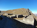
The Exilles Fort is a fortified complex in the Susa Valley, Metropolitan City of Turin, Piedmont, Northern Italy. Together with the nearby Fort of Fenestrelle and the Forte Albertino (at Vinadio, in the province of Cuneo) it was part of the defensive line between the House of Savoy lands (later of the Kingdom of Italy) and France: both these states held it in different phases depending on the outcome of the various wars. It is located on a spur commanding one of the narrowest sections of the Susa Valley, along the main road connecting Turin to France.
History
The first mention of a fortified structure in the place dates from the 7th century, when a chronicler of the Abbey of Novalesa wrote of a fortification on the spur overlooking Exilles, perhaps destroyed by the Franks. Starting from 1155, the fort was held by the Bermond family of Besançon, counts of Albon, who owned the road passing near it and leading to the Monginevro Pass.
The first description of the castle dates from 1339: it had a quadrangular plan with more towers, quite different from the massive structure visible today. Between 1494 and 1496 it was used as an ammunition depot by Charles VIII of France, who enlarged the main entrance and enrolled peasants of the area to defend it. In the 16th century it was further reinforced with more towers under Charles II of Savoy. In 1541 it was again under French rule, though, according to the Treaty of Cateau-Cambrésis (1559), it was reacquired by Emmanuel Philibert of Savoy. In 1591 it was recaptured by the French after a short siege, but two years later Charles Emmanuel I of Savoy took it back and strengthened it, in particular on the side facing the upper Susa Valley.
In 1595, after a month-long siege, it was again in French hands. The Savoyards would receive it back only in 1708, after the War of the Spanish Succession. In this century the French strongly rebuilt the fort. In 1720 the Piedmontese revised it under the direction of military engineer Ignazio Bertola. In 1745, during the War of the Austrian Succession, the French attacked the fort, but were pushed back.
When Napoleon Bonaparte conquered Italy in the early 19th century, the fort was demolished. It was rebuilt in 1818–1829, updating the pre-existing architecture to more modern military concepts. The fort belonged to the Italian Army until 1943, after which it was abandoned. In 1978 the Piedmontese Regional Authority acquired it and launched a restoration program. The fort was opened to the public in 2000, housing the Museo Nazionale della Montagna (National Mountain Museum) and occasional exhibitions.
The famous historical character known as L'homme au masque de fer (The Man in the Iron Mask) spent some years captive in the fortress jail.
Text from Wikipedia, the free encyclopedia, under CC BY-SA 4.0. Full article: «Fort of Exilles».
Timeline
- 1339Built
Events and people from Wikidata (CC0).
Photos
Getting there
ExillesTrain, nearest
1.3 km as the crow flies
Fort of ExillesVia degli Alpini, 10050 Exilles
Distances are as the crow flies, not walking or driving.
Loading map…
Nearby
See on the mapMore fortresses and towers in Piedmont


Frequently asked questions
Where is Fort of Exilles?
Fort of Exilles is in Exilles, in the province of Torino (Piedmont), Italy. Address: Via degli Alpini, 10050 Exilles. GPS coordinates: 45.09963, 6.93642.
How old is Fort of Exilles?
Wikidata dates it to 1339.
What else is there to see near Fort of Exilles?
Nearby you’ll find: Fortino di Serre la Garde (1.6 km away), Forte Sapé (3 km away), Forte Fenil (3.5 km away).
Sources and licences
Text. Wikipedia, the free encyclopedia (CC BY-SA 4.0).
Data. Wikidata (CC0); opening hours and contacts OpenStreetMap (ODbL).
Photos. Wikimedia Commons, author and licence on every image.
Credits for the 9 photos
- Fort d'Exilles en fin de journée (septembre 2024) — Florian Pépellin, CC BY-SA 4.0
- Exilles - Forte di Exilles - 2025-09-29 15-34-11 001 — Federico_Milesi, CC BY-SA 4.0
- Exilles Forte di Exilles Cappella 1 — Zairon, CC BY-SA 4.0
- Exilles Forte di Exilles Lato Est 1 — Zairon, CC BY-SA 4.0
- Exilles Forte di Exilles Lato Nord 01 — Zairon, CC BY-SA 4.0
- Exilles (province of Torino, Italy) and its fortress on the background — K.Weise, Public domain
- Exilles et son fort dans le Piémont en soirée (septembre 2024) — Florian Pépellin, CC BY-SA 4.0
- Fort d'Exilles côté ouest en fin de journée (septembre 2024) — Florian Pépellin, CC BY-SA 4.0
- Fort d'Exilles — Josep Renalias Lohen11, CC BY-SA 3.0
Updated 28 October 2026. All sources and licences