


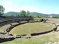


Archaeological site, Montesarchio (BN)
41°03′40″ N, 14°37′60″ E
No photo on Wikimedia Commons yet
At a glance
- Type
- Archaeological site
- Coordinates
- 41°03′40″ N, 14°37′60″ E
History and description
Caudium (modern Montesarchio) was the main city of the ancient Caudini tribe in Samnium situated on the Appian Way between Beneventum (modern Benevento) and Capua, in what is now southern Italy. It was 21 Roman miles from Capua, and 11 from Beneventum. It, or nearby Arpaia, became the seat of an early bishopric, which is now a Latin Catholic titular see.
History
In early times it was an important site, either the capital or chief city of the Caudini. Grave goods, found in the necropolis nearby, show that the site was inhabited from the 8th to the 3rd centuries.
Caudium is first mentioned during the Second Samnite War, when in 321 BC the Samnite army under Gaius Pontius encamped there just before their great victory over the Romans in the nearby mountain pass called the Caudine Forks (Livy 9.2), whose exact location is disputed. A few years later, the Samnites used Caudium as a place from which to watch the Campanians (Liv. 9.27).
Caudium is not mentioned during the Second Punic War, but the Caudini are repeatedly mentioned. Niebuhr supposed that the city was destroyed by the Romans in revenge for their great defeat at the Caudine Forks, but there is no evidence for this, and in a later period it was known as a stopping place along the Appian Way, both in the time of Augustus (Hor. Sat. 1.5.51; Strabo 5. p. 249) and in the late empire.
In the triumviral period Caudium received a colony of veterans; and it appears from Pliny, as well as from inscriptions, that it retained its municipal character, though deprived of a large portion of its territory in favor of the neighboring city of Beneventum. (Plin. iii. 11. s. 16; Lib. Colon. p. 232; Orelli, Inscr. 128, 131.)
The period of its destruction is unknown: the name is still found in the 9th century, but it is uncertain whether the town still existed at that time.
Text from Wikipedia, the free encyclopedia, under CC BY-SA 4.0. Full article: «Caudium».
Photos
Getting there
San Martino Valle Caudina - Montesarchio - PannaranoTrain, nearest
3.2 km as the crow flies
Caudium
Aeroporto di Napoli Capodichino35.0 km
Distances are as the crow flies, not walking or driving.
Loading map…
Nearby
See on the mapDo you know this place?
We are missing the opening hours and photos. The data comes from open projects: if you add it there, it appears here at the next update.
More archaeological sites in Campania

- UNESCO
- Free 1st Sunday

- UNESCO

- UNESCO

- UNESCO
- Free 1st Sunday

- Free 1st Sunday
Frequently asked questions
Where is Caudium?
Caudium is in Montesarchio, in the province of Benevento (Campania), Italy. GPS coordinates: 41.06111, 14.63333.
What else is there to see near Caudium?
Nearby you’ll find: Montesarchio (600 m away), Torre di Montesarchio (1 km away), National Archaeological Museum of Sannio Caudino (1 km away).
Sources and licences
Text. Wikipedia, the free encyclopedia (CC BY-SA 4.0).
Data. Wikidata (CC0); opening hours and contacts OpenStreetMap (ODbL).
Photos. Wikimedia Commons, author and licence on every image.
Credits for the 2 photos
- Appian Way — Livioandronico2013, CC BY-SA 4.0
- Shepherd-c-030-031 — Historical Atlas by William R. Shepherd 1911 edition, Public domain
Updated 28 October 2026. All sources and licences