

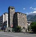


Castle, Charvensod (AO)
45°43′21″ N, 7°19′33″ E
No photo on Wikimedia Commons yet
At a glance
- Type
- Castle
- Elevation
- 729 m above sea level
- Coordinates
- 45°43′21″ N, 7°19′33″ E
About
No English description yet
Opening hours and directions are on this page. The full story is on Italian Wikipedia.
Read it in ItalianGetting there
Aosta / AosteTrain, nearest
1.3 km as the crow flies
Charvensod Castle
Aeroporto regionale della Valle d'Aosta / Aéroport régional de la Vallée d'Aoste3.8 km
Distances are as the crow flies, not walking or driving.
Loading map…
Nearby
See on the mapDo you know this place?
We are missing the opening hours, a description and photos. The data comes from open projects: if you add it there, it appears here at the next update.
More castles in Aosta Valley


Frequently asked questions
Where is Charvensod Castle?
Charvensod Castle is in Charvensod (Aosta Valley), Italy. GPS coordinates: 45.72245, 7.32570.
What else is there to see near Charvensod Castle?
Nearby you’ll find: Bramafam Tower (1.4 km away), Tour du Pailleron (1.4 km away), Leper's Tower (1.5 km away).
Sources and licences
Data. Wikidata (CC0); opening hours and contacts OpenStreetMap (ODbL).
Updated 28 October 2026. All sources and licences