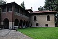


Castle, Legnano (MI)
45°36′03″ N, 8°54′47″ E
No photo on Wikimedia Commons yet
At a glance
- Type
- Castle
- Materials
- Stone, brick
- Coordinates
- 45°36′03″ N, 8°54′47″ E
History and description
The Cotta Castle (Italian: Castello dei Cotta) was an early medieval fortification present in Legnano from the 10th to the 13th/14th centuries in the area where the modern Leone da Perego Palace and INA Gallery stand. It was one of the military outposts used during the Battle of Legnano on May 29, 1176.
Position in local geography
The presence of a castle in Legnano is related to the strategic function the locality had from the early Middle Ages to the 16th century. Legnano was located along an important communication route from the Olona Valley and connected Milan to northwestern Lombardy.
This road, which had existed since Roman times, was the Via Severiana Augusta. It connected Mediolanum with Verbannus Lacus or Lake Maggiore. Napoleon Bonaparte later took over its route to make the Simplon highway. The defense of Legnano was important because its eventual conquest could have allowed the enemies of the Lordship of Milan access to Seprio via the Olona Valley, which ends at Castellanza, and to the capital city itself through the use of the aforementioned road.
In the Middle Ages, Legnano, although according to some authors it belonged to Seprio, gravitated around Milan. The Cotta castle served as a defensive bulwark of the Milanese countryside and, by extension, of Milan as well. The link between Milan and the city of the Carroccio was not only military but also economic, as Legnano supplied foodstuffs.
For these reasons, the Milanese archbishops Leone da Perego and Ottone Visconti often stayed in Legnano. He established his residence at the Cotta castle because he preferred it, as a military outpost, to the Braida Arcivescovile, located in the city center of Legnano, which was deemed insufficiently secure. The castle, however, was difficult to expand unless a large number of dwellings were demolished.
The Cotta castle was also the protagonist of the Battle of Legnano which took place on May 29, 1176. It was one of the military garrisons of the Lombard League during the armed clash with Frederick Barbarossa. The League's choice to place the carroccio at Legnano before the clash with Barbarossa was not fortuitous but related to the easy access to the Milanese countryside: this gateway had to be closed and defended to prevent an attack on Milan.
History
The Cotta castle was most likely built in the 10th century to counter Hungarian raids. The first core of the manor was presumably a watchtower, to which was added a cita mural: its structure was thus very simple. In the 11th century, the latter was completed by the addition of a fortified palace.
The Cotta castle had a rectangular shape measuring 22m by 6.5m and possessed various rooms for the garrisons and the captain of arms. In addition to the defensive works of the castle, there were also a moat into which part of the waters of the Olonella had been diverted, and walls that enclosed the town of Legnano. The walls, which were about one meter thick, were renovated in the 13th century. The outline of the built-up area of early medieval Legnano was still recognizable from the map of the Catasto Teresiano, which was made in 1722, while the course of part of the walls can still be identified today by following the route of modern streets Palestro, Giulini, and Corridoni.
The Cotta castle was demolished between the 13th and 14th centuries. In fact, in the Notitiae Cleri Mediolanensi of 1398, it appears that in place of the Cotta castle were located the convent of the Umiliati and the church of Santa Maria del Priorato, which were themselves demolished in 1953.
The gradual fortification of the complex was the work of the Cotta family. This family was a vassal of the archbishop of Milan and took part in the latter's struggle against the Seprio countryside. The first Cotta to settle in the castle were Amizio and his son Erlembaldo in 1014. They were imperial envoys. Owning a fortification in their name, it is presumable that part of the settlement was enfeoffed by this noble lineage with the approval of the archbishop of Milan. This epoch was characterized by the steady growth of archiepiscopal power over Legnano, which began to free itself from imperial power. …
Text from Wikipedia, the free encyclopedia, under CC BY-SA 4.0. Full article: «Castello dei Cotta».
Photos
Getting there
LegnanoTrain, nearest
800 m as the crow flies
Castello dei Cotta
Aeroporto internazionale Milano Malpensa "Silvio Berlusconi"14.9 km
Distances are as the crow flies, not walking or driving.
Loading map…
Nearby
See on the mapDo you know this place?
We are missing the opening hours and photos. The data comes from open projects: if you add it there, it appears here at the next update.
More castles in Lombardy


Frequently asked questions
Where is Castello dei Cotta?
Castello dei Cotta is in Legnano, in the province of Milano (Lombardy), Italy. GPS coordinates: 45.60090, 8.91306.
What else is there to see near Castello dei Cotta?
Nearby you’ll find: Guido Sutermeister Museum (0 m away), Villa Bernocchi (100 m away), Torre Colombera (400 m away).
Sources and licences
Text. Wikipedia, the free encyclopedia (CC BY-SA 4.0).
Data. Wikidata (CC0); opening hours and contacts OpenStreetMap (ODbL).
Photos. Wikimedia Commons, author and licence on every image.
Credits for the 4 photos
- 0317 - Milano - San Calimero - Foto Giovanni Dall'Orto 5-May-2007 — Giovanni Dall'Orto, Attribution
- Palazzo Leone da Perego (Legnano) - facciata principale 2 — Dario Crespi, CC BY-SA 3.0
- Palazzo Leone da Perego Pirovano (Legnano) — Giuseppe Pirovano (1818-1902), Public domain
- Porta di Sotto — Giuseppe Pirovano (1818-1902), Public domain
Updated 28 October 2026. All sources and licences