




Photo: S4mb0r4, CC BY-SA 3.0 · Wikimedia Commons
At a glance
- Type
- Fortress / Tower
- Protection
- Italian national heritage
- Coordinates
- 42°39′32″ N, 13°42′20″ E
- Address
- piazza Sant'Anna - 64100 Teramo
History and description
Teramo is a city and comune in the Italian region of Abruzzo, the capital of the province of Teramo.
The city, 150 kilometres (93 miles) from Rome, is situated between the highest mountains of the Apennines (Gran Sasso d'Italia) and the Adriatic coast. The town is located by the confluence of the Vezzola and Tordino rivers, on a hillside area where the terrain features along with the Mediterranean climate make the territory rich in vineyards and olive groves.
The economy of the town is mostly based on activities connected with agriculture and commerce, as well as a sound industrial sector: textiles, foods, engineering, building materials and ceramics. Teramo can be reached from the A14 and the A24 motorways.
History
A settlement of the 1st millennium BC and some buildings of ancient Italic tribes were the object of archaeological excavations. The most ancient historical remains were found in the outskirts of the city, precisely in the neighborhood Madonna delle grazie, where, among many, a burial place with a dagger and a halberd were found. Allegedly, the development of the old settlement was due to the commercial center founded by the Etruscan civilization.
According to the Roman author Sextus Julius Frontinus, the ancient Perut or Pretut (meaning "Hill surrounded by waters") strongly developed in dimensions and importance until it became the capital of the Praetutii tribe.
In the battle of Sentinum (295 BC), the Romans defied the Italian confederation (Sabellians, Etrusci, Umbri and their allies the Gauls), starting the Samnite Wars. In 290 BC, the Sabine area, along with the Praetutii's region was occupied by the legions sent by the consul Manius Curius Dentatus. The city took the Latin name of Interamnia Praetuttiorum or Interamnia Praetutia ("City of the Praetutii between two rivers"). During the reign of Augustus Interamnia is included in the Picenum district. The area of the current province was divided from south to north into the Ager Hatrianus, Ager Praetutianus and Ager Palmense.
After the Second Social War, Interamnia became a municipium. The city lost the status of Municipium because of the participation of Lucius Cornelius Sulla in the Social war (91–88 BC), but the city will subsequently regain it for expressed will of Julius Caesar.
During the Roman age, thanks to its nearness to the capital of the empire, the city lived a prosperous and favorable moment as proven by the numerous mosaics, theater, thermal baths and the amphitheater remains. As historians like Ptolemy, Livy and Pliny remember, the city reached its best period under the emperor Hadrian, with the constructions of the temples dedicated to Mars and Apollo. …
Main sights
The city's main attractions include:
the Cathedral of Saint Berardo, built in 1158 by bishop Guido II, in Romanesque style. It has a portal in Gothic style, finished in 1332 by the Roman master Deodato di Cosma. It houses a silver antependium by Nicola of Guardiagrele (with 35 scenes of the life of Jesus) and a polyptych by the Venetian artist Jacobello del Fiore depicting the Incoronation of the Virgin. Annexed is a 50-metre-tall (164-foot) bell tower.
the Romanesque church of Sant'Antonio (1127), with a decorated portal. The interior, with a single nave, was renovated along Baroque lines.
the church of San Getulio, built in the early Middle Ages on the ruins of a Roman temple, finally destroyed in 1155 by the Normans. Only the presbyterium and some Romanesque elements of the original building remain today.
the church of San Domenico (14th century) with a fine Virgin with Child.
the sanctuary of the Madonna delle Grazie (also known as Chiesa di Santa Maria delle Grazie). It has a Romanesque cloister and a 15th-century miraculous wooden statue of the Virgin, attributed to Silvestro dell'Aquila.
the Palazzo Vescovile ("Bishops Palace"), from the 14th century.
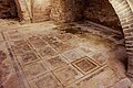
the remains of the Roman theatre (built about 30 BC) and of the amphitheatre (about 3rd–4th century AD). Under Palazzo Savini are remains of a Roman domus, including a 1st-century BC opus tessellatum pavement which depicts a fighting lion and other decorative elements.
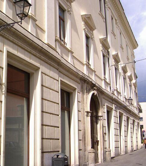
the Torre Bruciata ("Burnt Tower"), a Roman tower from the 2nd century BC, in opus quadratum. The name derives from the traces left by the siege in 1156 by Robert III of Loritello.
Church of Santa Maria de Praediis (10th–11th centuries), built using materials from the destroyed castle and Roman villas and temples.
Text from Wikipedia, the free encyclopedia, under CC BY-SA 4.0. Full article: «Torre Bruciata».
Getting there
TeramoTrain, nearest
900 m as the crow flies
Torre Bruciatapiazza Sant'Anna - 64100 Teramo
Distances are as the crow flies, not walking or driving.
Loading map…
Nearby
See on the mapMore fortresses and towers in Abruzzo


Frequently asked questions
Where is Torre Bruciata?
Torre Bruciata is in Teramo, in the province of Teramo (Abruzzo), Italy. Address: piazza Sant'Anna - 64100 Teramo. GPS coordinates: 42.65877, 13.70557.
What else is there to see near Torre Bruciata?
Nearby you’ll find: Domus e mosaico del Leone (0 m away), Casa dei Melatino (100 m away), Aprutium (100 m away).
Sources and licences
Text. Wikipedia, the free encyclopedia (CC BY-SA 4.0).
Data. Wikidata (CC0); opening hours and contacts OpenStreetMap (ODbL).
Photos. Wikimedia Commons, author and licence on every image.
Credits for the 1 photos
- TorreBruciata — S4mb0r4, CC BY-SA 3.0
Updated 28 October 2026. All sources and licences