


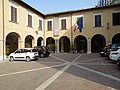


Photo: Interminatispazi, CC BY-SA 4.0 · Wikimedia Commons
Fortress / Tower, 1564
Fortress of Civitella del Tronto
Fortress in Civitella del Tronto (TE), Italy
Civitella del Tronto (TE), Abruzzo
At a glance
- Type
- Fortress / Tower
- Period
- Renaissance, 1564
- Style
- Renaissance
- Protection
- Italian national heritage
- Coordinates
- 42°46′23″ N, 13°40′04″ E
History and description
Fortezza di Civitella del Tronto (Italian for Fortress of Civitella del Tronto) is a fortress in Civitella del Tronto, Province of Teramo (Abruzzo).
Description
The Fortezza di Civitella del Tronto is a fortified structure erected as a stronghold aimed at controlling the territory, with tactical and defensive functions. This powerful structure was built to protect the strategic area it occupies, rising near the rocky ridge overlooking the urban center of Civitella del Tronto, the seat of the homonymous Abruzzo municipality, in the province of Teramo.
The complex of the defensive settlement represents one of the most important strongholds of the Kingdom of Naples during the Spanish Viceroyalty and imposing military engineering works carried out on the soil of Southern Italy. Due to its size, it can be compared to the Forte della Brunetta, built by the Piedmontese near the city of Susa and the Hohensalzburg Fortress in Salzburg, with which it has been twinned since 1989. Its constructions extend for a length of about 500 meters and an average width of 45 meters, covering an area of 25,000 m2.
With its 45,000 annual visitors (2016 data), it has been the most visited monument in Abruzzo.
The site is primarily remembered for being the last bastion of the Kingdom of the Two Sicilies to surrender to the Piedmontese on March 20, 1861, three days after the coronation of King Vittorio Emanuele II.
History
Historical sources attest to the existence of writings from the 11th century mentioning the village of Civitella. The year 1001 is mentioned, referring to a donation deed signed by Raterio, son of Giuseppe, describing the curtis of Tibitella, guarding the border of the Salinello between the Ascoli county and the Aprutina county. This was followed, in 1069, by another donation deed signed by Siolfo, son of Trasmondo and grandson of Trasmondo, who assigned the ownership of the castle of Civitellae to Stefano, Bishop of Ascoli.Civitella was positioned to guard the Salinello border, and in the centuries that followed, the vicissitudes of the defensive garrison saw the alternation of the retreat or advance of the territorial demarcation line dividing the sovereignty of the two jurisdictions.
On January 30, 1255, Pope Alexander IV confirmed the power over the fortress to Teodino, Bishop of Ascoli, and urged the Ascolans to fortify and repair the castle of Civitella.
Later, Charles I of Anjou, organizing a defensive restructuring of the kingdom, decided to strengthen some castles, including the repair of Civitella in 1269.
Between the 12th and 13th centuries, the fortress saw an increase in its inhabitants, from thirty in 1269 to sixty in 1271. In 1273, advanced ammunition and siege engines were brought there for the conquest of Castel Manfrino.A document from 1276, during Angevin domination, refers to a castle as "just built," probably indicating information about consolidation or renewal works of Swabian constructions.
Two parchments, kept in the Ascoli State Archive, confirm that after 1387, 13 probivi (governing officials) of Civitella publicly assembled and appointed two ambassadors to be sent to Ascoli to negotiate with the local "Council of Elders" to place their homeland under "obedience, protection, and defense" of the city jurisdiction. A document from 1426 validates the payment of compensation "to four master carpenters and two transporters from Ascoli" for transferring a bombard to the fortress. …
Architecture
There are no traces of the layout of the older defensive urban fortress construction. It is hypothesized, however, that it had a fortified core enclosed within a city wall.The fortification gained substantial form during the Swabian period and later under the rule of the Angevins, owing to its strategic position near the border between the Kingdom of Naples and the emerging Papal States.
From 1564, the structure of the fort underwent modifications and expansions to achieve its current configuration, as ordered by the King of Spain and Naples, Philip II of Habsburg, who reinforced the earlier Angevin fortifications and the Aragonese fortress.
The Angevins, aiming to adapt and modernize the pre-existing Swabian constructions to fit their military strategies and techniques, added circular flanking towers at the corners and along the straight walls, possibly crenellated and equipped with projecting apparatuses typical of the late Middle Ages, serving as breaches, remnants of which are still visible.
In the period leading up to the Siege of the War of the Two Trontos in 1557, recalled in chronicles and engravings of the surrounding camp, the fortification walls were shaped according to the principles of modern fortification and were equipped with bastions, reinforcements, and counterscarps, as required for the use of firearms.From 1639 to 1711, the settlement underwent maintenance work aimed solely at repairs and improvements.
The current fortress is a complex defensive structure designed to meet technical and functional needs. It comprises architectures from various periods organized on different levels, interconnected by 19th-century ramps. Its ensemble is built on an elliptical plan covering the entire summit area of the hill, predominantly made of squared blocks of travertine and housing extensive parade grounds, battlements, covered walkways, trenches, bastions, the Carmine battery, punishment cells like the "Cocodrillo Dungeon" of Aragonese origin water cisterns, stables, offices, smithies, soldier and officer quarters, munitions depots, mess halls and kitchens, a bakery, a chapel dedicated to Saint Barbara, patron saint of artillerymen, a church, and a residential palace. …
Museum of Arms and Ancient Maps
Within the constructions of the Civitella fortress, originally designated for kitchens and mess halls, the Museum of Arms and Ancient Maps was inaugurated in 1988. Its premises consist of four exhibition halls showcasing maps, weapons, and other objects related to the history and various fortunes of the fortress.
In the hall dedicated to Giorgio Cucentrentoli di Monteloro, the museum houses more modern artifacts, including a papal helmet from 1848 belonging to the troops of Pius IX, a pontifical diplomatic uniform, documents, and weapons associated with the Garibaldian and House of Savoy eras.
The Risorgimento Hall displays weapons that belonged to the Bourbon and Savoy armies. Of particular interest is a representation of Civitella from 1557.
The third hall features a central boundary marker column. This column marked the demarcation line between the Papal State and the Kingdom of the Two Sicilies. Engraved on the upper part of the shaft are the keys of St. Peter with the date 1847, the Bourbon lily, and the progressive number 609.
The Renaissance Hall houses the oldest weapons in the exhibition, including matchlock muskets from the 15th century, flintlock pistols from the 18th century, and depictions of the fortress from the 18th century and 19th century.
On August 28, 2015, the museum was dedicated to Major Raffaele Tiscar in a dedication ceremony attended by the authorities of Civitella and the great-grandson of Major Piergiorgio Tiscar. The plaque affixed at the museum entrance reads: "The municipality of Civitella del Tronto, in memory of the last siege of this fortress, a proud bastion through the centuries, dedicates the Museum of Arms and the Fortress to Major RAFFAELE TISCAR, a Bourbon officer who, faithful to his oath, stood alongside Commander La Piazza until, as dictated by King Francesco II, he was given the ungrateful task of signing the surrender of the fortress to the besieging Piedmontese Command. It was March 20, 1861."
Text from Wikipedia, the free encyclopedia, under CC BY-SA 4.0. Full article: «Fortress of Civitella del Tronto».
Timeline
- 1564Built
Events and people from Wikidata (CC0).
Photos
Getting there
MaltignanoTrain, nearest
8.0 km as the crow flies
Fortress of Civitella del Tronto
Distances are as the crow flies, not walking or driving.
Loading map…
Nearby
See on the mapMore fortresses and towers in Abruzzo


Frequently asked questions
Where is Fortress of Civitella del Tronto?
Fortress of Civitella del Tronto is in Civitella del Tronto, in the province of Teramo (Abruzzo), Italy. GPS coordinates: 42.77314, 13.66764.
How old is Fortress of Civitella del Tronto?
Wikidata dates it to 1564.
What else is there to see near Fortress of Civitella del Tronto?
Nearby you’ll find: Civitella del Tronto (200 m away), Nina, museo delle arti creative tessili (200 m away), Santuario di Santa Maria dei Lumi (800 m away).
Sources and licences
Text. Wikipedia, the free encyclopedia (CC BY-SA 4.0).
Data. Wikidata (CC0); opening hours and contacts OpenStreetMap (ODbL).
Photos. Wikimedia Commons, author and licence on every image.
Credits for the 9 photos
- Fortezza di Civitella del Tronto, Abruzzo — Interminatispazi, CC BY-SA 4.0
- Civitella del Tronto - Fortezza di Civitella del Tronto - 202209031646 3 — Riccardodd, CC BY-SA 4.0
- Civitella del Tronto - Fortezza di Civitella del Tronto - 202209031646 — Riccardodd, CC BY-SA 4.0
- Civitella del Tronto - Fortezza di Civitella del Tronto - 202209031710 2 — Riccardodd, CC BY-SA 4.0
- Civitella del Tronto - Fortezza di Civitella del Tronto - 2026-09-27 20-58-18 001 — Cristina_Morettini_95, CC BY-SA 4.0
- Civitella del Tronto - bell — Przemek Pietrak, CC BY-SA 3.0
- Civitella del Tronto - fort street — Przemek Pietrak, CC BY-SA 3.0
- Civitella del Tronto (1) — Przemek Pietrak, CC BY-SA 3.0
- 64010 Citivella del Tronto TE, Italy - panoramio - trolvag (11) — trolvag, CC BY-SA 3.0
Updated 28 October 2026. All sources and licences