


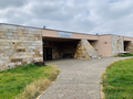


Photo: Benjamin Smith, CC BY-SA 4.0 · Wikimedia Commons
Archaeological site
Sanctuary of Hera Lacinia
Ancient Greek sanctuary of Hera at Capo Colonna near Crotone, Italy
At a glance
- Type
- Archaeological site
- Dedicated to
- Hera
- Coordinates
- 39°01′35″ N, 17°12′17″ E
History and description
The Temple of Juno Lacinia (as a Roman goddess, originally Hera Lacinia) is a ruined ancient Greek temple at the heart of a sanctuary dedicated to Hera located on Capo Colonna in Calabria, Italy, near Crotone (ancient Kroton). The main remaining feature is a Doric column with capital, about 27 feet (8.2 m) in height.
The site lies on a promontory formerly called Lacinion in a strategic position along the coastal routes linking Taranto to the Strait of Messina. The venerated goddess, Hera Lacinia, was named after the location.
The sanctuary was later included in the larger Roman town of Lacinium.
History
The oldest (imported) ceramic finds from the 8th century suggest that the area of the Lacinio promontory was a place of worship even before the arrival of the Greek colonists, but are not significant for evidence of Greek visits prior to the colonial phase. These finds from the first cult area were below "Building B" which dates from the early 6th century BC as testified by the rich votive offerings including masterpieces in gold, silver and bronze. The most important building of the sanctuary later became the large Doric temple (A), built on a different alignment near the edge of the cliff around 480-470 BC on top of a previous archaic temple from the 7th century.
The sanctuary was dependent on ancient Kroton and was one of the most important in Magna Graecia until the 4th century BC. Building phases are datable to eras from the 6th century BC to the 3rd century AD.
The via sacra (great processional way), 60 m long and over 8 m wide, was created in the 4th century BC after which two vast public buildings for pilgrims were built. They had symmetrical plans with internal courtyards and peristyles: the katagogion (hotel for pilgrims) and the hestiatorion (banquet building). The wall of the temenos (sanctuary precinct) probably dates to the 4th century BC.
The federal treasury of the Italiote League, which brought together all the Greeks of the West, was moved there in the 5th century BC, and remained there until relocated to Herakleia near Tarentum.
The famous painter Zeuxis created many paintings for the Temple in the late 5th c. BC some of which had been preserved till Cicero's (106-43 BC) day. His most famous painting there was of Helen of Troy intended to depict the ideal female beauty. The painting was later brought to Ambracia by Pyrrhus of Epirus (318-272 BC) after the Pyrrhic War. When the Romans captured Ambracia in 189 BC they brought it to Rome where Pliny the Elder saw it in the Portico of Philip.
Hannibal had his final camp nearby before evacuating Italy in 206 BC, staying there three winters toward the close of the Second Punic War, and dedicated a bronze plaque inscribed in Punic and Greek there detailing his accomplishments. …
Description
The temple has been described as "perhaps the most splendid [structure] in southern Italy".
The sanctuary was in an area of forest (lucus)) sacred to the goddess. Hera is, in Greek mythology, the greatest of the goddesses, mother of Zeus and of other deities and heroes, and also the greatest protector of women and of all aspects of female life, but she is also venerated as Mother Nature, protector of animals and of sea travel. Hera also protected in particular the cattle which grazed freely within the forest.
The Doric temple had six columns in front (hexastyle) with a total of 48 columns over 8 m tall. The remaining column rests on the remains of the mighty stylobate. The roof was covered with Parian marble tiles. Architectural fragments found show the colourful terracotta detailing used.
The grand sacred way connected the sanctuary with the sacred forest and the coastal landing points. It must have also continued further eastwards and ended in a sort of square, where the religious processions that wound their way around this majestic artery converged and where, perhaps, was the altar mentioned in the sources but the strong erosion of the edge of the promontory must have destroyed this part.
The sanctuary includes at least three other buildings: "B”, "H” and "K”.
This building could well have been the first temple, later replaced by the more visible classical temple. Its proportions, the several renovations it underwent in a short period and its proximity to the later temple show its considerable importance as the first place of worship in the sanctuary.
It was discovered in 1987 and is a large building with a rectangular plan (approximately 22 x 9 m) oriented at an angle to the later temple. The building, of which the foundation rows remain, made extensive use of calcarenite available directly on the promontory, crushed into small flakes on the northern side of the building. …
Text from Wikipedia, the free encyclopedia, under CC BY-SA 4.0. Full article: «Sanctuary of Hera Lacinia».
People
Events and people from Wikidata (CC0).
Photos
Getting there
CrotoneTrain, nearest
10.5 km as the crow flies
Sanctuary of Hera Lacinia
Aeroporto Pitagora di Crotone11.2 km
Distances are as the crow flies, not walking or driving.
Loading map…
Nearby
See on the mapMore archaeological sites in Calabria


Frequently asked questions
Where is Sanctuary of Hera Lacinia?
Sanctuary of Hera Lacinia is in Crotone, in the province of Crotone (Calabria), Italy. GPS coordinates: 39.02649, 17.20475.
What else is there to see near Sanctuary of Hera Lacinia?
Nearby you’ll find: Capo Colonna archaeological area (0 m away), Capo Colonne Lighthouse (100 m away), Cape Nao Tower (200 m away).
Sources and licences
Text. Wikipedia, the free encyclopedia (CC BY-SA 4.0).
Data. Wikidata (CC0); opening hours and contacts OpenStreetMap (ODbL).
Photos. Wikimedia Commons, author and licence on every image.
Credits for the 9 photos
- Capo Colonna - Colonna — Benjamin Smith, CC BY-SA 4.0
- Crotone, parco archeologico di capo colonna, tempio di hera lacinia, 01 — Sailko, CC BY-SA 4.0
- Crotone, parco archeologico di capo colonna, tempio di hera lacinia, 02 colonna dorica — Sailko, CC BY-SA 4.0
- Crotone, parco archeologico di capo colonna, tempio di hera lacinia, 02 e faro — Sailko, CC BY-SA 4.0
- Crotone, parco archeologico di capo colonna, tempio di hera lacinia, 03 capitello dorico — Sailko, CC BY-SA 4.0
- Crotone-Hera-Tempel-1986-gje — Gerd Eichmann, CC BY-SA 4.0
- Crotone, parco archeologico di capo colonna, mura del santuario 01 — Sailko, CC BY-SA 4.0
- Area archeologica di Capo Colonna — Revolweb, CC BY-SA 2.0
- Capo Colonna - Colonna & Faro — Benjamin Smith, CC BY-SA 4.0
Updated 28 October 2026. All sources and licences