


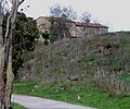


Photo: LepoRello, CC BY-SA 3.0 · Wikimedia Commons
Archaeological site
Rusellae
Archaeological site in Tuscany
At a glance
- Type
- Archaeological site
- Protection
- Italian national heritage
- Coordinates
- 42°49′38″ N, 11°09′34″ E
- Address
- via dei Ruderi, 46 ‒ 58040 Roselle (GR)
History and description
Rusellae was an important ancient town of Etruria, Italy, which survived until the Middle Ages before being abandoned. The impressive archaeological remains lie in the modern frazione of Roselle, near the city of Grosseto, Tuscany.
The remains of the ancient buildings were brought to light by means of a long campaign of excavations carried out under archaeologist Clelia Laviosa beginning in the 1950s. More recent work has revealed many more impressive buildings.
History
The first traces of settlement are shown in layers containing relics of Villanovan and at the end of 7th, early 6th century BC. Founded as a city in the 7th century BC, it was quoted by Dionysius of Halicarnassus as one of the cities that brought help to the Latins in the war against the Roman king Tarquinius Priscus. It developed to the detriment of neighbouring cities in particular Vetulonia.
Rusellae was associated with, but not actually one of, the twelve cities of the Etruscan Confederation. The discovery of Attic vases with red figures testifies to the city's commercial contacts with Greece and the Greek colonies of Southern Italy. The Romans captured it in 294 BC. In 205 BC, it contributed grain and timber for the fleet of Scipio Africanus. A colony was founded here either by the Triumviri or by Augustus.
The Diocese of Roselle was established in 490.
In 935 the town was destroyed by Saracens. It was not rebuilt because of a malaria epidemic.
In 1138 the diocese was suppressed and the site deserted, although still occasionally used. The episcopal see was transferred to Grosseto.
Archaeology
The impressive cyclopean walls were built by the Etruscans between the 7th and 6th centuries BC. The perimeter of the city wall is over 3 km, with an average height of about 7 m. The walls consist of irregular, unworked blocks of travertine often measuring as much as 2.75 by 1.2 metres (9.0 by 3.9 ft)
On the top of the hill north of the city, the amphitheatre dates from the 1st century AD and is the only one known among Etruscan coastal towns. The earth removed to create the arena was probably used as a base for the banks of seating.
The walls of opus reticulatum date from the early 1st century AD confirmed by the discovery of "sealed" Arretine ceramic. Inside the arena along the major axis, four stones aligned with regularly spaced holes were discovered that were probably used to divide with stage scenery.
During the early Middle Ages the building became a fortified enclosure using additional material from other Roman buildings, and in defence of Byzantine territories against the advance of the Lombards.
This area remained occupied until at least the 16th century, as evidenced by the various fragments of archaic majolica.
The first traces of the house (domus) date back to the late republican period. After extensive destruction in 90–80 BC, it was enlarged and restored, as well as enriched with three statues of Tiberius, Livia and Drusus Minor. During the Claudian era there was a partial destruction, perhaps due to a fire, followed by an immediate restoration. At the same time the house and its baths in the southern half became public rather than residential.
In the late Hadrianic or Antonine era the structure was subjected to heavy restructuring with the raising and widening of the baths and its appendages: this phase witnessed the installation of mosaics in the baths and tablinum. Other changes affected the position of the columns and fountain peristyle, while the small laconicum was adorned with stucco decorations in high relief. …
Text from Wikipedia, the free encyclopedia, under CC BY-SA 4.0. Full article: «Rusellae».
Photos
Getting there
GrossetoTrain, nearest
7.9 km as the crow flies
Rusellaevia dei Ruderi, 46 ‒ 58040 Roselle (GR)
Aeroporto di Grosseto10.1 km
Distances are as the crow flies, not walking or driving.
Loading map…
Nearby
See on the mapMore archaeological sites in Tuscany


- Free 1st Sunday
Frequently asked questions
Where is Rusellae?
Rusellae is in Grosseto, in the province of Grosseto (Tuscany), Italy. Address: via dei Ruderi, 46 ‒ 58040 Roselle (GR). GPS coordinates: 42.82718, 11.15931.
Can I visit Rusellae for free?
Yes: entry is free on the first Sunday of every month, under the Italian “Domenica al museo” scheme.
What else is there to see near Rusellae?
Nearby you’ll find: Walls of Rusellae (0 m away), Church of San Silvestro (0 m away), Roman Amphitheatre of Rusellae (100 m away).
Sources and licences
Text. Wikipedia, the free encyclopedia (CC BY-SA 4.0).
Data. Wikidata (CC0); opening hours and contacts OpenStreetMap (ODbL).
Photos. Wikimedia Commons, author and licence on every image.
Credits for the 9 photos
- Roselle Archaeological Park Central area 2 — LepoRello, CC BY-SA 3.0
- Area Archeologica Roselle (Grosseto) — Somebody.gr, CC0
- Area archeologica Roselle 1 — Patafisik, CC BY-SA 3.0
- Area Archeologica Roselle Grosseto — Somebody.gr, CC0
- Building A of the the Northern area of the Forum, Rusellae, Etruria, Italy (43188312665) — Carole Raddato from FRANKFURT, Germany, CC BY-SA 2.0
- Building B of the the Northern area of the Forum, Rusellae, Etruria, Italy (30227138678) — Carole Raddato from FRANKFURT, Germany, CC BY-SA 2.0
- Building C of the the Northern area of the Forum, Rusellae, Etruria, Italy (30227135638) — Carole Raddato from FRANKFURT, Germany, CC BY-SA 2.0
- Entrata al Decumano, Roselle — Patafisik, CC BY-SA 3.0
- Mosaico romano Roselle 1 — Patafisik, CC BY-SA 3.0
Updated 28 October 2026. All sources and licences