





Photo: Udimu, CC BY-SA 4.0 · Wikimedia Commons
Archaeological site
Cosa
Latin colony founded ca. 273 BCE
At a glance
- Type
- Archaeological site
- Coordinates
- 42°24′39″ N, 11°17′11″ E
History and description
Cosa was an ancient Roman city near the present Ansedonia in southwestern Tuscany, Italy. Its substantial remains are situated on a hill 113 m above sea level and 140 km northwest of Rome on the Tyrrhenian Sea coast.
History
The original Etruscan town of Cusi or Cosia may have been where modern Orbetello stands as evidenced by the massive fortification wall in polygonal masonry still standing on Orbetello's lagoon. After the defeat of Etruscan Vulci by the Romans and the confiscation of its territory in 280 BC, the Roman reorganisation of the area centred on the establishment of Cosa as a Latin colony in 273 BC on the Ager Cosanus, land confiscated from the defeated Etruscans, to solidify the control of the Romans and offer the Republic a protected port. The town was linked to Rome by the Via Aurelia from about 241 BC.
The Second Punic War (218 to 201 BC), in which Hannibal had left a trail of devastation across Italy, affected the town like many Latin colonies and the rich bought up both public land and the small farms of the poor. New colonists arrived in 197 BC. Cosa seems to have prospered again until it suffered a crisis in the Roman Republican civil wars and in the 60s BC when it became depopulated. As part of land redistribution, a group of large villas was assembled in the area, run by slave labour, similar to the latifundia estates typical of southern Italy. These villas included nearby Settefinestre, the largest at "Le Colonne" (Capalbio), "La Provinia", and one at the port of Cosa.
It was rebuilt under Augustus. Cosa appears to have been affected by an earthquake in 51 AD, which occasioned the reconstruction of the republican Basilica as an Odeon under the supervision of Lucius Titinius Glaucus Lucretianus, who also worked on the Capitoline temple. However, as early as 80, Cosa seems to have been almost deserted. It was revived under the emperor Caracalla, during whose reign the portico around the forum was built, concealing two large granaries. At the same time, the odeon was restored, a Mithraeum constructed in the basement of the Curia, and a sanctuary to Liber erected at the southeast end of the Forum. …
The City
Within the city walls the urban area was divided into an orthogonal plan with space allotted for civic, sacred and private buildings. The plan represents a subtle adaptation of an orthogonal plan to the complicated topography of the hill. The forum was found on a saddle between two heights with the sacred area, the Capitolium, linked to it by a broad street. Recent excavations have suggested that the original layout provided for about 248 houses, of which 20 were intended for the decurions, and were double the size of the houses of the ordinary citizens. The larger houses were found on the forum and the main processional streets.
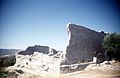
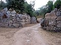
The city wall of Cosa was built at the time of the foundation of the colony in 273 BC. It is 1.5 km (0.93 miles) long and built in polygonal masonry of Lugli's third type. It included a system of interval towers, numbering eighteen in all. These are found at irregular intervals, and all but one are rectangular in plan - the exception is round. There are three gates which correspond to as many roads: the northwest, or Florentine gate, which corresponds to the modern entrance to the site, the northeast, or Roman gate, and the southeast, or maritime gate. Each has the same structure, twin gates, one in line with the walls and one to the inside, with a space between them. The arx also had an independent circuit wall. At the western corner of this was a postern, closed in the early Byzantine period, when the hill was refortified with a wall built with an emplecton. A final, medieval circuit in mortared rubble masonry runs along the same line.
In recent years, the Archaeological Soprintendenza of Tuscany has conducted extensive documentation, repairs, and reconstructions of the walls. …
Middle Ages
Cosa appears in some documents dating from the 11th century, although a 9th-century occupation is suggested by frescoes at the abbey of S. Anastasio alle Tre Fontane in Rome, recording the capture of the site by Charlemagne and Pope Leo III. However, no sign of occupation between the eighth and the tenth centuries has been recovered. By the end of the 10th century, a small cemetery was found next to a church built over a temple facing the forum. The town is recorded as Ansedoniam civitatem in a privilege of Pope Gregory VII (1073-1085).
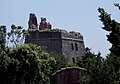
Occupation of the site began with a few sunken-floored buildings, but by the 11th century, it was concentrated on the Eastern Height, now surrounded by a double bank and ditch. In the 12th century, a tower was built in the centre of these fortifications, with a large cistern on two sides. That this cistern was subsequently used as a prison is suggested by graffiti on its plaster lining, one of which gives the date of 1211.
The castle, belonging to the Aldobrandeschi family in 1269, was destroyed by the Sienese army in 1329, on the pretext that it was occupied by bandits. A catapult or trebuchet base found on the Eastern Height may have formed part of the defences at this time. The site remained deserted after this time.
Text from Wikipedia, the free encyclopedia, under CC BY-SA 4.0. Full article: «Cosa».
Photos
Getting there
Orbetello-Monte ArgentarioTrain, nearest
5.4 km as the crow flies
Cosa
Distances are as the crow flies, not walking or driving.
Loading map…
Nearby
See on the mapMore archaeological sites in Tuscany


- Free 1st Sunday
Frequently asked questions
Where is Cosa?
Cosa is in Orbetello, in the province of Grosseto (Tuscany), Italy. GPS coordinates: 42.41092, 11.28650.
Can I visit Cosa for free?
Yes: entry is free on the first Sunday of every month, under the Italian “Domenica al museo” scheme.
What else is there to see near Cosa?
Nearby you’ll find: Temple of Jupiter (0 m away), Museo Archeologico Nazionale (200 m away), City wall of Cosa (300 m away).
Sources and licences
Text. Wikipedia, the free encyclopedia (CC BY-SA 4.0).
Data. Wikidata (CC0); opening hours and contacts OpenStreetMap (ODbL).
Photos. Wikimedia Commons, author and licence on every image.
Credits for the 9 photos
- Cosa map — Udimu, CC BY-SA 4.0
- Cosa (273 av. J. C.) — André Corboz, CC BY-SA 4.0
- Cosa (I) (4746030090) — Institute for the Study of the Ancient World from New York, United States of America, CC BY 2.0
- Cosa (II) (4745391613) — Institute for the Study of the Ancient World from New York, United States of America, CC BY 2.0
- Cosa (III) (4746030394) — Institute for the Study of the Ancient World from New York, United States of America, CC BY 2.0
- Cosa, lastricato romano 01 — Sailko, CC BY 3.0
- Cosa05 — Mac9, CC BY-SA 2.5
- Panorama con Torre della Tagliata (Torre Puccini) dal Porto di Cosa (GR) — Matteo Vinattieri, CC BY 3.0
- Porto di Cosa (GR) — Matteo Vinattieri, CC BY 3.0
Updated 28 October 2026. All sources and licences