
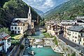


Photo: Maria grazia schiapparelli, CC BY-SA 4.0 · Wikimedia Commons
Archaeological site
Plan des Sorcières
Archaeological site in Aosta Valley (Italy)
Lillianes (AO), Aosta Valley
At a glance
- Type
- Archaeological site
- Protection
- Italian national heritage
- Coordinates
- 45°37′09″ N, 7°53′01″ E
- Address
- Località La Vallessaz (nei pressi del colle Portola)
Photos
Getting there
Pont-Saint-MartinTrain, nearest
7.6 km as the crow flies
Plan des SorcièresLocalità La Vallessaz (nei pressi del colle Portola)
Distances are as the crow flies, not walking or driving.
Loading map…
Nearby
See on the mapDo you know this place?
We are missing the opening hours and a description. The data comes from open projects: if you add it there, it appears here at the next update.
More archaeological sites in Aosta Valley


Frequently asked questions
Where is Plan des Sorcières?
Plan des Sorcières is in Lillianes (Aosta Valley), Italy. Address: Località La Vallessaz (nei pressi del colle Portola). GPS coordinates: 45.61904, 7.88365.
What else is there to see near Plan des Sorcières?
Nearby you’ll find: Fontainemore (3.7 km away), Charles Castle (5.2 km away), Tour d'Hérères (5.4 km away).
Sources and licences
Data. Wikidata (CC0); opening hours and contacts OpenStreetMap (ODbL).
Photos. Wikimedia Commons, author and licence on every image.
Credits for the 4 photos
- Plan des sorcieres — Maria grazia schiapparelli, CC BY-SA 4.0
- Coppelle - Lillianes (AO) 004 — Aangelo, Public domain
- Lillianes, pietra con 7 coppelle — Aangelo, Public domain
- Pietra con coppella e canaletti — Aangelo, Public domain
Updated 28 October 2026. All sources and licences