At a glance
- Area
- 300 m²
- Protection
- Italian national heritage
- Coordinates
- 40°17′05″ N, 8°44′59″ E
- Address
- Località Bara, Macomer
Getting there
Macomer ARSTTrain, nearest
2.6 km as the crow flies
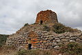
Nuraghe SuccoronisLocalità Bara, Macomer
Distances are as the crow flies, not walking or driving.
Do you know this place?
We are missing the opening hours and a description. The data comes from open projects: if you add it there, it appears here at the next update.
More archaeological sites in Sardinia
Archaeological site Barumini (VS)
Opening hours
Archaeological site Pula (CA)
Opening hours
Archaeological site Sassari (SS)
Opening hours
Archaeological site Paulilatino (OR)
Opening hours
Archaeological site Orune (NU)
Opening hours
Archaeological site Carbonia (CI)
Opening hours
See all archaeological sites in Sardinia
Things to see in Macomer: 35 historic places
Frequently asked questions
Where is Nuraghe Succoronis?
Nuraghe Succoronis is in Macomer, in the province of Nuoro (Sardinia), Italy. Address: Località Bara, Macomer. GPS coordinates: 40.28470, 8.74972.
What else is there to see near Nuraghe Succoronis?
Nearby you’ll find: Necropolis of Filigosa (1.8 km away), Nuraghe Tamuli (3.8 km away), Nuraghe Orolo (5.4 km away).
Sources and licences
Data. Wikidata (CC0); opening hours and contacts OpenStreetMap (ODbL).
Photos. Wikimedia Commons, author and licence on every image.
Credits for the 8 photos
- Macomer, nuraghe Succoronis (02) — Gianni Careddu, CC BY-SA 4.0
- 14 668 Nuraghe Succuronis — Falk2, CC BY-SA 4.0
- Macomer, nuraghe Succoronis (01) — Gianni Careddu, CC BY-SA 4.0
- Nuraghe Succoronis Macomer — Dragonjack97, CC BY-SA 4.0
- Nuraghe Succoronis — Antonio Figoni, CC BY-SA 4.0
- 14 683 Karstquelle Su Golgone — Falk2, CC BY-SA 4.0
- 14 684 Su Golgone, Mündung — Falk2, CC BY-SA 4.0
- Nuraghic Tower under Dramatic Sky - panoramio — horsch, CC BY-SA 3.0
Updated 28 October 2026. All sources and licences
Spotted a mistake? Fix it on OpenStreetMap