


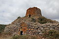


- UNESCO
Photo: Gianni Careddu, CC BY-SA 3.0 · Wikimedia Commons
Opening hours and directions are on this page. The full story is on Italian Wikipedia.
Read it in ItalianDistances are as the crow flies, not walking or driving.


Nuraghe Tamuli is in Macomer, in the province of Nuoro (Sardinia), Italy. Address: Localita' Tamuli, Macomer. GPS coordinates: 40.26083, 8.71778.
According to OpenStreetMap the opening hours are: Every day: 9:30–18:00. Always check the official website before your visit.
Nearby you’ll find: Necropolis of Filigosa (4.8 km away), Nuraghe Elighe Onna (7.7 km away), Tomba dei giganti di Palatu (8.2 km away).
Data. Wikidata (CC0); opening hours and contacts OpenStreetMap (ODbL).
Photos. Wikimedia Commons, author and licence on every image.
Updated 28 October 2026. All sources and licences