

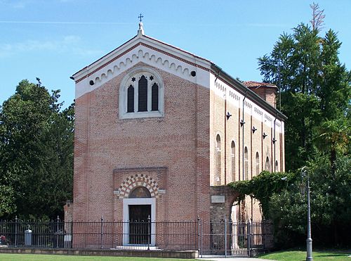
Photo: Luigi Prearo, CC BY-SA 2.0 · Wikimedia Commons
At a glance
- Type
- Museum
- Coordinates
- 44°56′41″ N, 12°16′52″ E
- Address
- Via Veneto, 38, 45019 Taglio di Po
About
No English description yet
Opening hours and directions are on this page. The full story is on Italian Wikipedia.
Read it in ItalianPhotos
Getting there
Pomposa Zona IndustrialeTrain, nearest
13.5 km as the crow flies
Museo Regionale della Bonifica di Ca' VendraminVia Veneto, 38, 45019 Taglio di Po
Distances are as the crow flies, not walking or driving.
Loading map…
Nearby
See on the map- Centro di Documentazione della Civiltà contadina e della pesca3.8 km
 Museo del bosco e del cervo della Mesola4.7 km
 Castello Estense della Mesola4.7 km
 Torre Abate4.7 km
 Museo delle Api - Centro Apicoltura di Ca' Cappellino5.3 km
 Archaeological Museum of Saint Basilio8.2 km
 Area archeologica di San Basilio8.4 km
 Collection of Ocarinas of Grillara9.5 km
More museums in Veneto

- Free 1st Sunday


- Free 1st Sunday

- UNESCO
Frequently asked questions
Where is Museo Regionale della Bonifica di Ca' Vendramin?
Museo Regionale della Bonifica di Ca' Vendramin is in Taglio di Po, in the province of Rovigo (Veneto), Italy. Address: Via Veneto, 38, 45019 Taglio di Po. GPS coordinates: 44.94460, 12.28120.
What are the opening hours of Museo Regionale della Bonifica di Ca' Vendramin?
According to OpenStreetMap the opening hours are: Tuesday to Sunday: 9:30–12:30, 15:00–18:00. Always check the official website before your visit.
What else is there to see near Museo Regionale della Bonifica di Ca' Vendramin?
Nearby you’ll find: Centro di Documentazione della Civiltà contadina e della pesca (3.8 km away), Museo del bosco e del cervo della Mesola (4.7 km away), Castello Estense della Mesola (4.7 km away).
Sources and licences
Data. Wikidata (CC0); opening hours and contacts OpenStreetMap (ODbL).
Photos. Wikimedia Commons, author and licence on every image.
Credits for the 2 photos
- Ex idrovora Cà Vendramin — Luigi Prearo, CC BY-SA 2.0
- Le turbine di Cà Vendramin — Luigi Prearo, CC BY-SA 2.0
Updated 28 October 2026. All sources and licences