
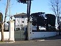


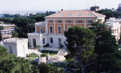


Photo: And y3 at English Wikipedia, CC BY-SA 3.0 · Wikimedia Commons
Fortress / Tower
Wall of Pope Urban VIII
Building in Rome, Italy
- Within the UNESCO World Heritage Site “Historic Centre of Rome, the Properties of the Holy See in that City Enjoying Extraterritorial Rights and San Paolo Fuori le Mura”
At a glance
- Type
- Fortress / Tower
- Commissioned by
- Urban VIII
- Coordinates
- 41°53′08″ N, 12°27′43″ E
History and description
The Janiculum walls (Italian: Mura gianicolensi) are a stretch of defensive walls erected in 1643 by Pope Urban VIII as a completion of the Leonine wall (defending the Vatican Hill) and for a better protection of the area of Rome rising on the right bank of the Tiber.
History
The need for a fortification, preventing access to Rome through its south-west side, derived from a conflict between two noble Roman families, the Barberini (the house of the Pontiff) and the Farnese, due to economic interests and to the policy of expansion of the former against the latter. The casus belli, cleverly arranged by Urban VIII himself, was the failure to pay to Barberinis the economic rents of the Duchy of Castro and Ronciglione (now in the province of Viterbo), governed by Odoardo I Farnese, the Duke of Parma and Piacenza and supported by Venice, the France of Richelieu and the Grand Duchy of Tuscany.
In the summer of 1641 the Pope himself, leading an army of 15,000 men with artilleries, marched against the Duchy, occupying its territory and the town of Castro: in effect, the economic interests concealed political matters, as well as a kind of feud between rival families, and Urban was waiting for nothing but a pretext to set off the spark.
The "War of Castro", because of the involved powers, could however pose a threat also to the Holy See, the Barberini House and its properties in Rome. The town, though adequately protected, was nevertheless perilously exposed on the side of Janiculum (what's more, too close to the Vatican): on this side, the former wall erected by Emperor Aurelian was no more in condition to guarantee an effective protection.
The work was commissioned to Marcantonio De Rossi, a quite unknown architect, whose appointment was probably thanks to his friendship with the powerful Olimpia Maidalchini. The surveys began in 1641, the building at the end of the following year and in 1643 the work was completed. …
The layout
The area of Porta Portese, just a few meters from the present Ponte Sublicio, is the lowest of the whole layout: the rise to the Janiculum hill begins soon beyond, partly due to the raising of the ground level. Between the end of the 17th and the beginning of the 18th century, the whole area became the centre of various settlements relevant to river transports: just within the gate rose the Port of Ripa Grande, that was the main dock of the Tiber, in front of the ancient Emporium, while just outside, in 1714, Pope Clement XI built the new “Papal Arsenal”, used for the maintenance of the river commercial fleet of the Pope; the Arsenal operated until the end of the 19th century, when the building of the muraglioni (embankments) of the Tiber interrupted any activity related to the river. The only surviving memory of the Port are two ramps descending to the river.
After a short stretch north-westward, the wall makes a right angle southwest and goes on in a non-linear way flanking Viale delle Mura Portuensi up to Largo Bernardino da Feltre, just where probably it crossed the ancient Aurelian layout. Three coats of arm of Urban VIII are visible along this stretch, where the wall is not particularly high due to the raising of the ground level: they were placed in 1644, when the Pope had already died.
Obviously nothing is left of the bastion that rose where Viale Trastevere - opened during the kingdom of Umberto I - now runs; the wall is again visible, though quite degraded, along the rise of Viale Aurelio Saffi, on the right. In correspondence to the first curve on the left there is a tunnel dug under the wall, used as an air-raid shelter during war period.
The wall goes on climbing and, in correspondence to the last, narrow curve of Viale Saffi, a blind arch is visible, probably used as a tunnel to pass on the other side. After a further, short stretch southward, the wall suddenly turns right, always flanking the street, that now changes its name into Viale delle Mura Gianicolensi.
At the corner there is a quite battered plate, in memory of the works of restoration:
Next to the plate, a plaque …
Text from Wikipedia, the free encyclopedia, under CC BY-SA 4.0. Full article: «Wall of Pope Urban VIII».
People
Events and people from Wikidata (CC0).
Photos
Getting there
Quattro VentiTrain, nearest
800 m as the crow flies
Wall of Pope Urban VIII
Aeroporto di Roma-Ciampino14.5 km
Distances are as the crow flies, not walking or driving.
Loading map…
Nearby
See on the mapMore fortresses and towers in Lazio


- UNESCO


Frequently asked questions
Where is Wall of Pope Urban VIII?
Wall of Pope Urban VIII is in Rome, in the province of Roma (Lazio), Italy. GPS coordinates: 41.88552, 12.46206.
What else is there to see near Wall of Pope Urban VIII?
Nearby you’ll find: Villa Spada al Gianicolo (300 m away), Syriac sanctuary on Gianicolo hill (300 m away), Porta San Pancrazio (300 m away).
Sources and licences
Text. Wikipedia, the free encyclopedia (CC BY-SA 4.0).
Data. Wikidata (CC0); opening hours and contacts OpenStreetMap (ODbL).
Photos. Wikimedia Commons, author and licence on every image.
Credits for the 4 photos
- Porta San Pancrazio — And y3 at English Wikipedia, CC BY-SA 3.0
- Trastevere - mura gianicolensi 1040490 — Lalupa, CC BY-SA 3.0
- V Sciarra lungo le mura 1170970 — Lalupa, CC BY-SA 3.0
- V Sciarra lungo le mura feritoia 1170971 — Lalupa, CC BY-SA 3.0
Updated 28 October 2026. All sources and licences