


- UNESCO
Photo: Verity Cridland, CC BY 2.0 · Wikimedia Commons
Archaeological site
Ancient Phoenician and later Greek island city
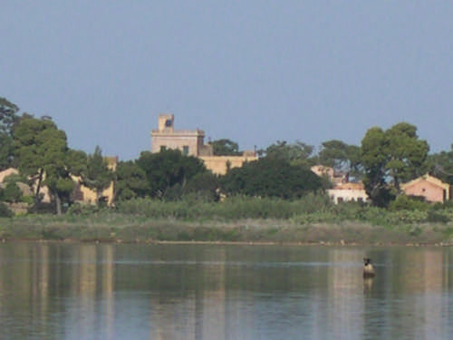
Motya was an ancient and powerful city on San Pantaleo Island off the west coast of Sicily, in the Stagnone Lagoon between Drepanum (modern Trapani) and Lilybaeum (modern Marsala). It is within the present-day commune of Marsala, Italy.
Many of the city's ancient monuments have been excavated and are visible today. Motya has become known for the marble statue of the Motya Charioteer, found in 1979 and on display at the local Giuseppe Whitaker museum.
Between the promontory of Lilybaeum (Capo Boéo) and that of Aegithallus (San Teodoro), the coast forms a deep bight, in front of which lies a long group of low rocky islets, called the Stagnone. Within these, and considerably nearer to the mainland, lies Motya island formerly called San Pantaleo, on which lie the remains of the ancient city. The island is nearly 850 m (2,790 ft) long and 750 m (2,460 ft) wide, and about 1 km (0.62 mi) (six stadia) from the mainland of Sicily. It was joined to the mainland in ancient times by a causeway, over which chariots with large wheels could reach the town.
The confined space on which the city was built agrees with the description of Diodorus that the houses were lofty and of solid construction, with narrow streets (στενωποί) between them, which facilitated the desperate defence of the inhabitants. Much of the walls, with those of two gateways, can be seen whose circuit is about 2.5 kilometres (1.6 mi).
The island of Motya is owned and operated by the Whitaker Foundation (Palermo), known for Marsala wines. The museum has artifacts that display Egyptian, Corinthian, Attic, Roman, Punic and Hellenic influences.
The Tophet, a type of cemetery for the cremated remains of children, possibly (but not entirely proven) as sacrifice to Tanit or Baʿal Hammon is exposed. Many of the ancient residences are open to the public.
The foundation of the settlement dates from the first half of the eighth century BC. Like Carthage, it was originally a Phoenician colony, who were fond of choosing similar sites, and probably was originally merely a commercial station or emporium, but gradually rose to be a flourishing and important town. The Phoenicians transformed the inhospitable island into one of the most affluent cities of its time, naturally defended by the lagoon.
By 650 BC the settlement had grown into a busy port-city with maritime trade extending to the central and western Mediterranean. This prosperity caused rivalry with powerful Carthage nearby on the North African coast, despite their ancient common ancestry. Towards the middle of the sixth century BC, Carthaginian forces led by General Malchus destroyed Motya. The city soon recovered and the population quickly rebuilt the city on a monumental scale and built the first defensive walls, some of the earliest in the central Mediterranean.
Motya is first mentioned by Hecataeus of Miletus, and Thucydides notes it among the chief colonies of the Phoenicians in Sicily at the time of the Athenian expedition in 415 BC. A few years later (409 BC) when the Carthaginian army under general Hannibal Mago landed at the promontory of Lilybaeum, he laid up his fleet for security in the gulf around Motya, while he advanced with his land forces along the coast to attack Selinus. After the fall of the latter city, we are told that Hermocrates, the Syracusan exile, who had established himself on its ruins, laid waste the territories of Motya and Panormus. During the second expedition of the Carthaginians under Hamilcar (407 BC), these two harbours became the permanent stations of the Carthaginian fleet.
In common with the other Phoenician settlements in Sicily, it passed under the government or dependency of Carthage, since Diodorus calls it a Carthaginian colony, but this may not be strictly correct. …
The Motya Charioteer sculpture found in 1979 is on display at the Giuseppe Whitaker museum. It is a rare example of a victor of a chariot race who must have been very wealthy in order to commission such a work. It was found built into Phoenician fortifications which were quickly erected before Dionysios I of Syracuse invaded and sacked Motya in 397 BC.
Its superb quality implies that it was made by a leading Greek artist in the period following their defeat of the Persians, but its style is unlike any other of this period. It is believed it must have been looted from a Greek city conquered by Carthage in 409-405 BC.
Recent archaeology carried out by La Sapienza University in the area of the "Kothon" found the earliest occupation of the Phoenician settlement dating from the second quarter of the 8th century BC. It started at the anchorage identified on the southern shore of the island, and grew around the nearby springs, where the earliest sacred area was erected (Temple C5). This area initiated rapid growth of the town and houses spread over the acropolis (which had already hosted a huge prehistoric village). Three main centres soon became established:
the southern housing quarter with public buildings (Building C8 and Temple C5)
the acropolis
the northern quarter with docks and industrial areas linked to the Sicilian coast opposite.
At least two thirds of the island were still left free for agriculture.
A cothon, as it usually spelled in English, is a typical feature of Phoenician ports. The cothon at Motya is an artificial lake on an otherwise very dry island that had long puzzled archaeologists since the first excavations by Joseph Whitaker in 1906/07. The lake was fed by the only fresh water spring on the island and enclosed with a rectangular, 52.5 m × 35.7 m (172 ft 3 in × 117 ft 2 in), perimeter wall of carved limestone blocks with a drain towards the sea. The basin, which was slightly bigger than an Olympic-sized swimming pool, was carved into the rock with a maximum depth of 2.5 metres (8 ft). …
Text from Wikipedia, the free encyclopedia, under CC BY-SA 4.0. Full article: «Mozia».
Distances are as the crow flies, not walking or driving.


Mozia is in Marsala, in the province of Trapani (Sicily), Italy. GPS coordinates: 37.86833, 12.46861.
Nearby you’ll find: Museo Archeologico Giuseppe Whitaker (200 m away), Burg on Marsala (8 km away), Complesso monumentale di San Pietro (8.1 km away).
Text. Wikipedia, the free encyclopedia (CC BY-SA 4.0).
Data. Wikidata (CC0); opening hours and contacts OpenStreetMap (ODbL).
Photos. Wikimedia Commons, author and licence on every image.
Updated 28 October 2026. All sources and licences